Login

Forgotten password?

Cookies have to be accepted!
Your browser's cookie functionality is disabled. Please enable this functionality.

Not a member yet?

Register now
Login

Available for registred users only

Log in to use this feature.

Forgotten password?

Cookies have to be accepted!
Your browser's cookie functionality is disabled. Please enable this functionality.

Not a member yet?

Register now
Filter
Categories
Advanced filters
  • Distance (km)
  • Height
Save filters Reset filter

TrackRank

QRCode

Technical data

Distance49,2 km Height1314 m Way down1317 m Duration04:00 h:m Date04.11.2007
Scores Author Landscape Fun factor Fitness Technique

Statistics

2284 Views 4 Scores 224 Downloads 4.00 Average
Rate
  • Track data sheet
  • Directions
  • Downloads

Tour durch den rheinischen Westerwald. Start und Ziel an den Tennisplätzen in Rengsdorf.
Streckenführung von 2007 Rww-Trophy MTB-Rengsdorf. Abwechslungsreiche Strecke mit tollen Ausblicken und dichten Wäldern. Gefahren wird auf den Spuren der Römer.

Viel Spaß auf tollen Touren!

Further information at

http://www.mtb-rengsdorf.de

Tour gallery

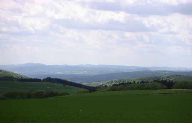
Tour map and elevation profile

  • Open Street Map
  • Google
Minimum height 115 m Maximum height 367 m Detailed view

More about the tour author

Klaus Goerg
Member since 2005

Send private message

Comments

privy on 09.02.2008

bin heute die tour nachgefahren, war klasse. sehr gut hat mir der schnepfenteich mit anschließendem singletrail gefallen.
loehr on 01.05.2009

weiter so

Das war meine dritte MTB-Rengsdorf Tour. Hat mir bis jetzt mit am besten gefallen. Sind ein paar sehr schöne Trails dabei mit teilweise sehr tollen Panorama.

56579 Rengsdorf bei Neuwied.

Aus Richtung A3 kommend am Ortseingang die erste Straße rechts und der Beschilderung zur Tennisterrasse folgen.

Aus Neuwied kommend am Ortsausgang links zu den Tennisplätzen.


Parkplätze sind am Wald vorhanden.

GPS tracks

Trackpoints
  • GPX / Garmin Map Source (gpx) download
  • TCX / Garmin Training Center® (tcx) download
  • CRS / Garmin Training Center® (crs) download
  • Google Earth (kml) download
  • G7ToWin (g7t) download
  • TTQV (trk) download
  • Overlay (ovl) download
  • Fugawi (txt) download
  • Kompass (DAV) Track (tk) download
  • Track data sheet (pdf) download
  • Original file of the author (gpx) download

More about the tour author

Klaus Goerg
Member since 2005

Send private message
Share track
Add to my favorites
Remove from my favorites
Edit tags
My score
Rate
Track: Touren im rheinischen Westerwald 4
Type: Mountain bike
Distance: 49,2 km
Evaluated on:
Duration:
Day(s)
Hour(s)
Minute(s)
Score: Landscape Fun factor Fitness Technique