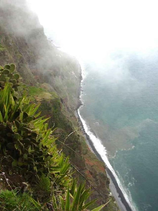
This is a walk in two parts, the first half is an easy walk from Estrieto de Camara de Lobos on the Levada do Norte, through the Ribiera da Caixa valley, and then onto the massive sea cliff of Cabo Girao.
This is the second highest sea cliff in Europe at 1902 feet sheer drop into the sea. The views to the east are amazing
The second part is a steep, knee wrenching descent by steps and road to the town of Camara de Lobos.
The GPS signal gets a bit confused at one point due to the geography, but this is during the Levada section so you cannot get lost.
Tour gallery
Tour map and elevation profile
Minimum height 37 m
Maximum height 603 m
Comments

The start point is at the village of Estreito de Camara de Lobos. You can take a number 96 bus from Funchal. The bus will stop about 600 mtr on from the church, with a sign across the road to the Levada do Norte.
The finish is in Camara de Lobos near the Taxi rank in front of the Harbour where you can get a refreshing beer and a return bus to Funchal
The finish is in Camara de Lobos near the Taxi rank in front of the Harbour where you can get a refreshing beer and a return bus to Funchal
GPS tracks
Trackpoints-
GPX / Garmin Map Source (gpx) download
-
TCX / Garmin Training Center® (tcx) download
-
CRS / Garmin Training Center® (crs) download
-
Google Earth (kml) download
-
G7ToWin (g7t) download
-
TTQV (trk) download
-
Overlay (ovl) download
-
Fugawi (txt) download
-
Kompass (DAV) Track (tk) download
-
Track data sheet (pdf) download
-
Original file of the author (g7t) download
Add to my favorites
Remove from my favorites
Edit tags
Open track
My score
Rate


