
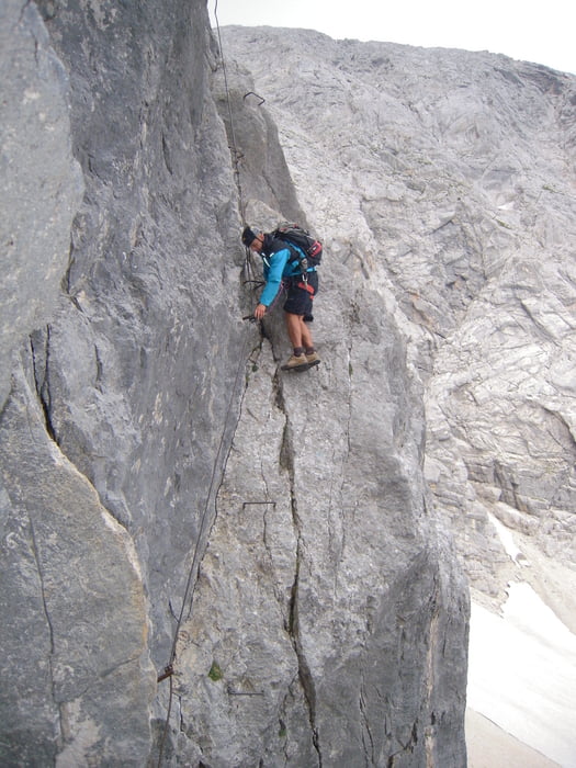

Začatek chůze parkoviště v Hinterstoderu. Je placené na více než dva dny 5 euro. Směr na chatu Prielschutzhaus. Asi 2h 30min. Z chaty k feratě na Gross Priel asi hodinu. Feratou na vrchol 3-4 hod. zpět na chatu kolem 2 hodin. Docela náročné ,ale moc pěkné hory.
Tour gallery


Tour map and elevation profile
Minimum height 568 m
Maximum height 2515 m
More about the tour author

|
Tomino119 |
Comments

Ze Severní moravy Ostrava, Olomouc, Brno směr Vídeň. Před Vídní odbočit na St. Pollten dále Linz směr Salczburg. Dále odbočka na Kirchdorf an der Krems. Pak už sledovat značky do Hinterstoderu. Ideální použít auto navigaci. Celá trasa bez problému.
GPS tracks
Trackpoints-
GPX / Garmin Map Source (gpx) download
-
TCX / Garmin Training Center® (tcx) download
-
CRS / Garmin Training Center® (crs) download
-
Google Earth (kml) download
-
G7ToWin (g7t) download
-
TTQV (trk) download
-
Overlay (ovl) download
-
Fugawi (txt) download
-
Kompass (DAV) Track (tk) download
-
Track data sheet (pdf) download
-
Original file of the author (gpx) download
More about the tour author
|
|
Tomino119 |
Add to my favorites
Remove from my favorites
Edit tags
Open track
My score
Rate