Login

Forgotten password?

Cookies have to be accepted!
Your browser's cookie functionality is disabled. Please enable this functionality.

Not a member yet?

Register now
Login

Available for registred users only

Log in to use this feature.

Forgotten password?

Cookies have to be accepted!
Your browser's cookie functionality is disabled. Please enable this functionality.

Not a member yet?

Register now
Filter
Categories
Advanced filters
  • Distance (km)
  • Height
Save filters Reset filter

TrackRank

QRCode

Technical data

Distance54,0 km Height953 m Way down906 m Duration04:00 h:m Date30.08.2013
Scores Author Landscape Fun factor Fitness Technique

Statistics

468 Views Scores 85 Downloads Average
Rate
  • Track data sheet
  • Directions
  • Downloads


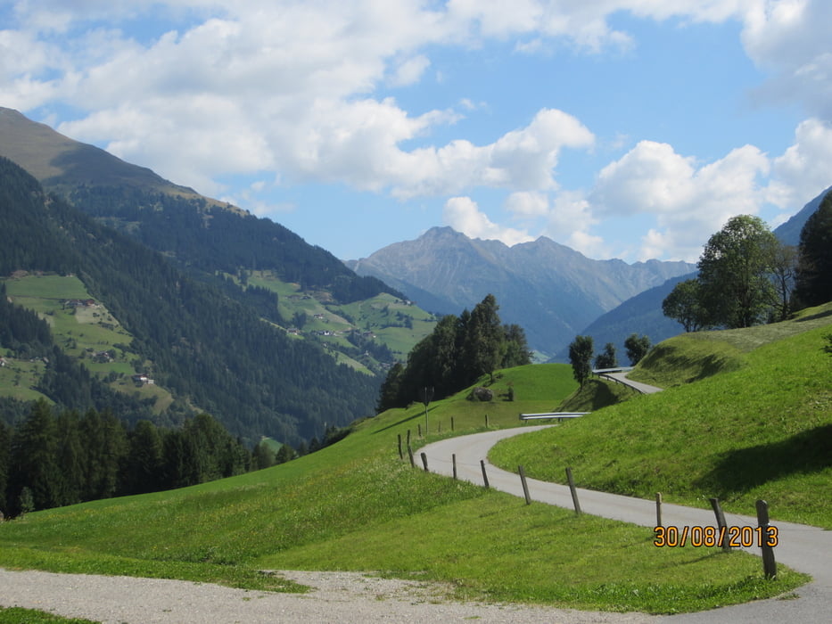
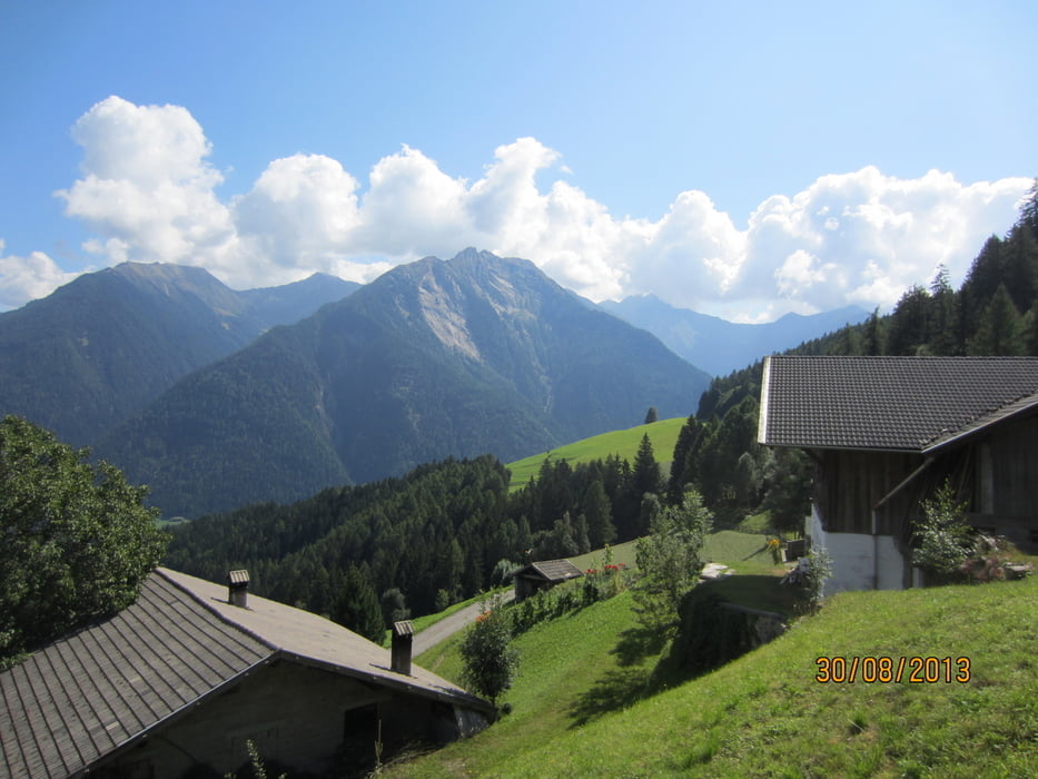
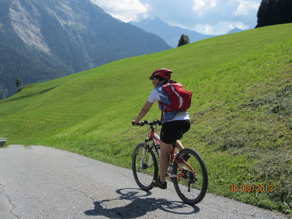
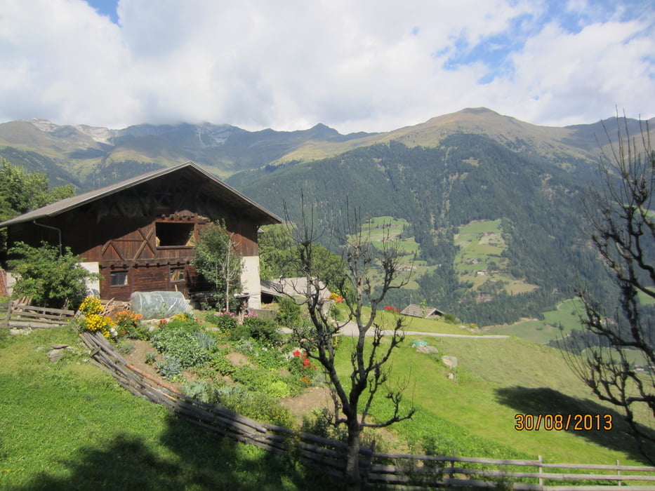
Gemütliche Tour. Von Meran auf dem Passerradweg nach St.Leonhard, weiter auf kaum befahrener Asphaltstrasse nach Braiteben(Gasthof), weiter zum Weiler Christl(Gasthof). Abfahrt nach St.Martin, und auf dem Radweg zurück zum Ausgangspunkt.

Schleife: gegen den Uhrzeigersinn.

Start/Ziel: Meran/Marling, Marlingerbrücke, Parkplatz neben Hotel Piccolo.

Tour gallery

Tour map and elevation profile

  • Open Street Map
  • Google
Minimum height 266 m Maximum height 1191 m Detailed view

More about the tour author

MargesinFriedrich
Member since 2012

Send private message

Comments

Inspektor64 on 26.08.2014

Dddfff

Ff

GPS tracks

Trackpoints
  • GPX / Garmin Map Source (gpx) download
  • TCX / Garmin Training Center® (tcx) download
  • CRS / Garmin Training Center® (crs) download
  • Google Earth (kml) download
  • G7ToWin (g7t) download
  • TTQV (trk) download
  • Overlay (ovl) download
  • Fugawi (txt) download
  • Kompass (DAV) Track (tk) download
  • Track data sheet (pdf) download
  • Original file of the author (gpx) download

More about the tour author

MargesinFriedrich
Member since 2012

Send private message
Share track
Add to my favorites
Remove from my favorites
Edit tags
My score
Rate
Track: Meran-Passeiertal-Braiteben-Christl-Meran
Type: Mountain bike
Distance: 54,0 km
Evaluated on:
Duration:
Day(s)
Hour(s)
Minute(s)
Score: Landscape Fun factor Fitness Technique