


- Rundkurs im Uhrzeigersinn
- Von KM 0-KM 5,5 einrollen auf Radweg, bzw. ruhigen Nebenstrassen.
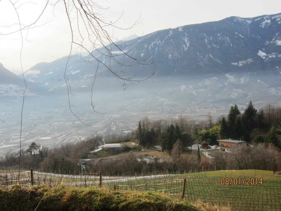
- Von KM 5,5 - KM 8,5 MH 300 - MH 540 Aufstieg auf kaum befahrener Teerstrasse, am malerischen Schloss Katzenstein vorbei ,zum höchsten Punkt.
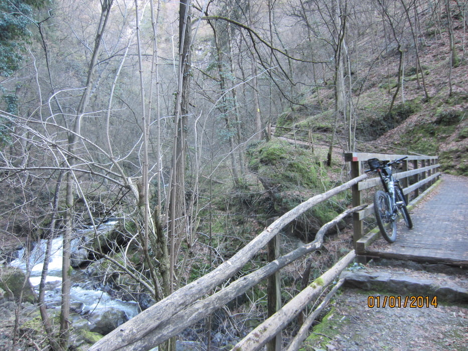
- Von KM 8,5 - KM 10,6 / MH 540-MH 265 Abfahrt auf perfektem Waldweg, bzw Trail-Abschnitt mit steinigem Untergrund, welcher eine sehr gute Beherrschung des Bike`s erfordert. Im Zweifelsfall mal ein paar Meter schieben.
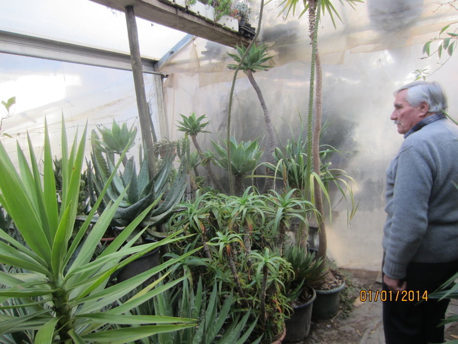
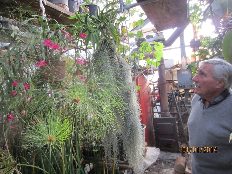
- Bei KM 9,1 liegt in einer Mulde gelegen der Gasthof MITTERWALDER. Luis, der sympathische Wirt hegt und pflegt seit 50 Jahren rund um den Gasthof seltene subtropische und tropische Pflanzen. Ich bin die Tour am 1.1.2014 gefahren und durfte mir das Winterquartier der exotischen Gewächse im beheizten Gewächshaus anschauen. Der weitgereiste Hobby- Botaniker hat mir viel über Herkunft und Besonderheiten seiner Schützlinge erzählt. Einige Bezeichnungen konnte ich mir merken: Elefantenohr-Kaktus, Pefferbaum, Cafe-Strauch, tropischer Oleander(hochgiftig), tropischer Tomatenbaum und Baumwollstrauch usw.
- Ich hatte den Eindruck, dass es den Luis freut, wenn jemand für seine Schützlinge Interesse zeigt.
- Start/Ziel: Meran/Marling, grosser öffentlicher Parkplatz neben dem Piccolo Hotel an der Marlinger Brücke.
Tour gallery
Tour map and elevation profile
Minimum height 263 m
Maximum height 551 m
More about the tour author
|
|
MargesinFriedrich |
Comments

GPS tracks
Trackpoints-
GPX / Garmin Map Source (gpx) download
-
TCX / Garmin Training Center® (tcx) download
-
CRS / Garmin Training Center® (crs) download
-
Google Earth (kml) download
-
G7ToWin (g7t) download
-
TTQV (trk) download
-
Overlay (ovl) download
-
Fugawi (txt) download
-
Kompass (DAV) Track (tk) download
-
Track data sheet (pdf) download
-
Original file of the author (gpx) download
More about the tour author
|
|
MargesinFriedrich |
Add to my favorites
Remove from my favorites
Edit tags
Open track
My score
Rate