
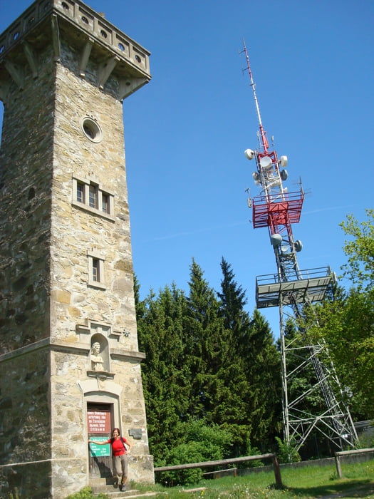

Über einen Naturlehrpfad geht es in das Burgholz zur sogenannten "Moarlackn". Von da an gehts es rechts zum Waldrand und stetig ansteigend weiter über Güter, Feld und Waldwege bis zur Elisabethwarte auf dem Plattenberg. Einkehrmöglichkeit im Gh. Plattenberg. Hier wird man nicht nur mit gutem Essen, sondern auch mit einer schönen Aussicht belohnt.
Tour gallery
Tour map and elevation profile
Minimum height 258 m
Maximum height 746 m
More about the tour author
|
|
5schrittezZ |
Comments

Anfahrt: A1 Abfahrt Haag und über den Tierpark Haag zur B 122 nach St. Peter in der Au.
Ausgangspunkt: Burgholzstraße (Abzweigung rechts von B 122 bei km 16,8) beim Roten Kreuz.
GPS tracks
Trackpoints-
GPX / Garmin Map Source (gpx) download
-
TCX / Garmin Training Center® (tcx) download
-
CRS / Garmin Training Center® (crs) download
-
Google Earth (kml) download
-
G7ToWin (g7t) download
-
TTQV (trk) download
-
Overlay (ovl) download
-
Fugawi (txt) download
-
Kompass (DAV) Track (tk) download
-
Track data sheet (pdf) download
-
Original file of the author (gpx) download
More about the tour author
|
|
5schrittezZ |
Add to my favorites
Remove from my favorites
Edit tags
Open track
My score
Rate