Login

Forgotten password?

Cookies have to be accepted!
Your browser's cookie functionality is disabled. Please enable this functionality.

Not a member yet?

Register now
Login

Available for registred users only

Log in to use this feature.

Forgotten password?

Cookies have to be accepted!
Your browser's cookie functionality is disabled. Please enable this functionality.

Not a member yet?

Register now
Filter
Categories
Advanced filters
  • Distance (km)
  • Height
Save filters Reset filter

TrackRank

QRCode

Technical data

Distance54,1 km Height692 m Way down689 m Duration03:20 h:m Date08.07.2014
Scores Author Landscape Fun factor Fitness Technique

Statistics

293 Views Scores 70 Downloads Average
Rate
  • Track data sheet
  • Directions
  • Downloads

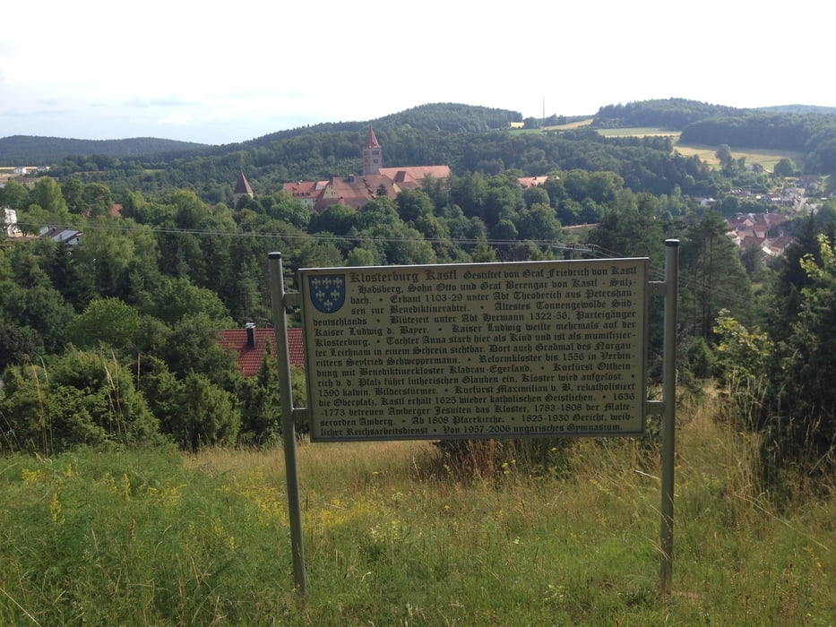
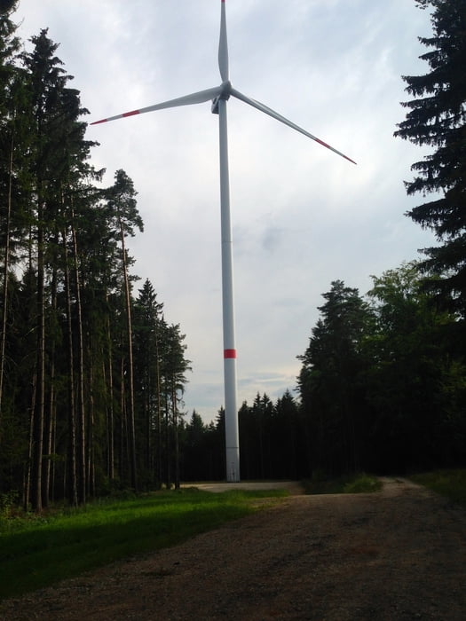
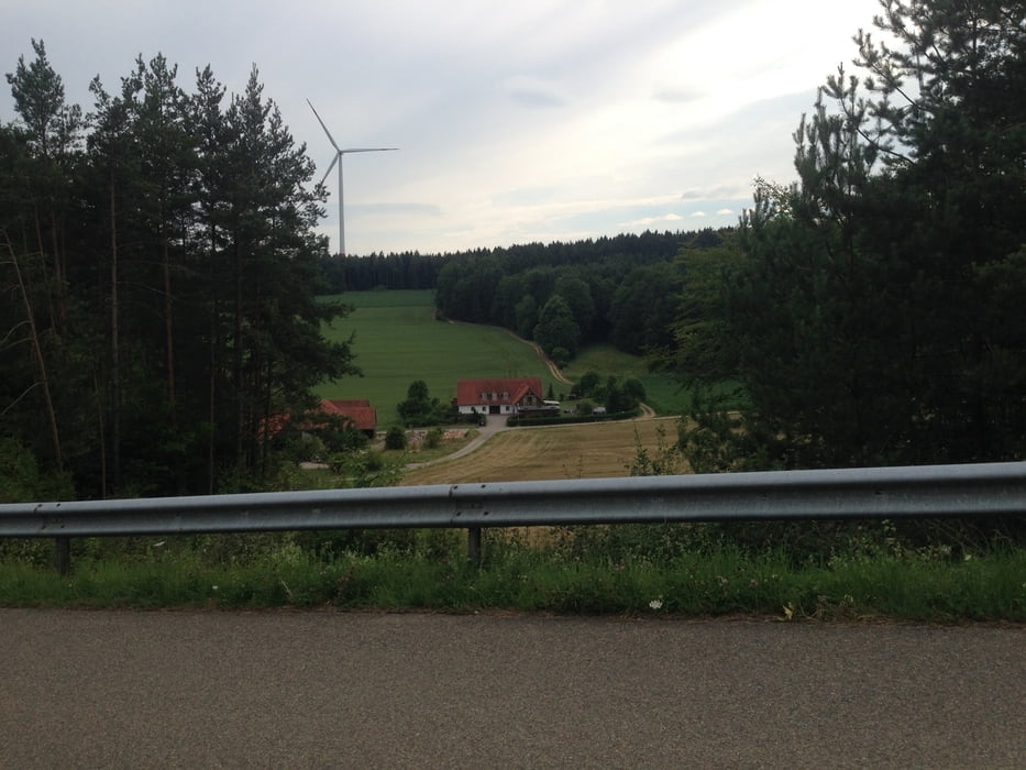
Wunderschöne Tour durch das Amberger Hinterland. Beeindruckend wieviele Windräder in unserem Landkreis aus dem Boden "geschossen" sind.


Tour gallery

Tour map and elevation profile

  • Open Street Map
  • Google
Minimum height 364 m Maximum height 578 m Detailed view

More about the tour author

Martin1210
Member since 2012

Send private message

Comments

Ich habe die Tour in Kümmersbruck begonnen.

Sie kann aber ebensogut an allen anderen Ortschaften auf der Route gestartet werden.

Viel Spaß beim Biken !


GPS tracks

Trackpoints
  • GPX / Garmin Map Source (gpx) download
  • TCX / Garmin Training Center® (tcx) download
  • CRS / Garmin Training Center® (crs) download
  • Google Earth (kml) download
  • G7ToWin (g7t) download
  • TTQV (trk) download
  • Overlay (ovl) download
  • Fugawi (txt) download
  • Kompass (DAV) Track (tk) download
  • Track data sheet (pdf) download
  • Original file of the author (gpx) download

More about the tour author

Martin1210
Member since 2012

Send private message
Share track
Add to my favorites
Remove from my favorites
Edit tags
My score
Rate
Track: Windradtour
Type: Mountain bike
Distance: 54,1 km
Evaluated on:
Duration:
Day(s)
Hour(s)
Minute(s)
Score: Landscape Fun factor Fitness Technique