


Unterhalb der Gaststätte Maltermeisterturm geht es links sanft
bergauf über den Alter Windeweg. Von hier aus scharf rechts bis zum
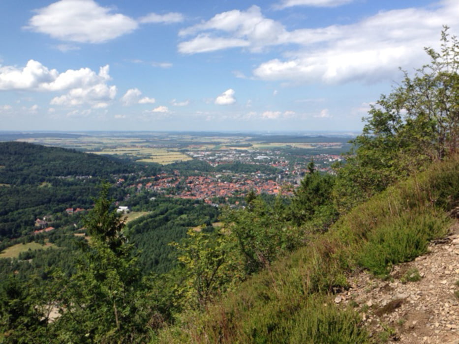
Aussichtspunkt Ramseck von wo aus Sie einen herrlichen Ausblick auf die Stadt
Goslar haben. Weiter bis zur Waldschrathütte, dem höchsten Punkt dieser
Wanderung in 600 m Höhe. Zurück über den Borchersweg zum Ausgangspunkt am
Maltermeisterturm.
bergauf über den Alter Windeweg. Von hier aus scharf rechts bis zum
Aussichtspunkt Ramseck von wo aus Sie einen herrlichen Ausblick auf die Stadt
Goslar haben. Weiter bis zur Waldschrathütte, dem höchsten Punkt dieser
Wanderung in 600 m Höhe. Zurück über den Borchersweg zum Ausgangspunkt am
Maltermeisterturm.
Further information at
http://www.forsthaus-braunlage.de/harz-blog/tag/wandern-harz/Tour gallery
Tour map and elevation profile
Minimum height 99999 m
Maximum height -99999 m
More about the tour author

|
forsthaus |
Comments

Benutzen Sie den Parkplatz oberhalb des Bergbaumuseums Rammelsberg am
Maltermeisterturm.
Maltermeisterturm.
GPS tracks
Trackpoints-
GPX / Garmin Map Source (gpx) download
-
TCX / Garmin Training Center® (tcx) download
-
CRS / Garmin Training Center® (crs) download
-
Google Earth (kml) download
-
G7ToWin (g7t) download
-
TTQV (trk) download
-
Overlay (ovl) download
-
Fugawi (txt) download
-
Kompass (DAV) Track (tk) download
-
Track data sheet (pdf) download
-
Original file of the author (gpx) download
More about the tour author
|
|
forsthaus |
Add to my favorites
Remove from my favorites
Edit tags
Open track
My score
Rate