


Zu Beginn der Wanderung folgt man der Wegbeschreibung zum Appel Haus - Richtung Backenstein ist ein Hinweis leicht zu übersehen.
Bis zur Abzweigung zum Ziel sind ca. 800 hm zurückzulegen.
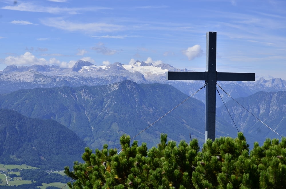
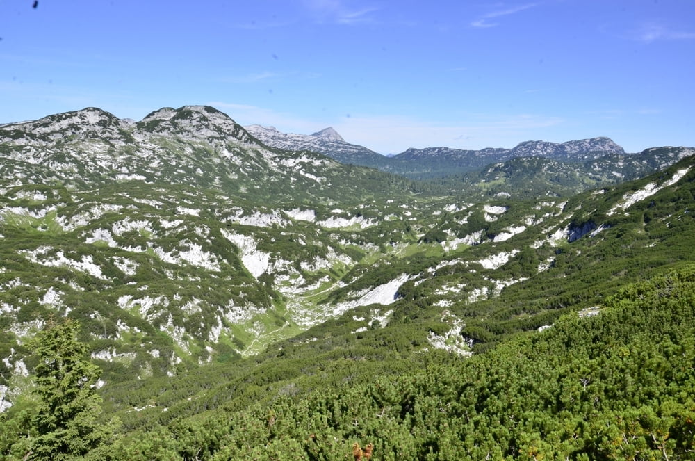
Ab dort kann es durch die Mischung Erde und Fels bei Nässe leicht rutschig sein. Der Blick vom Gipfel ist sehr vielversprechend vom Toten Gebirge den Schladminger Tauern bis zum Dachstein ist alles dabei. Das Gipfelkreuz liegt etwas tiefer als der höchste Punkt.
Tour gallery
Tour map and elevation profile
Minimum height 760 m
Maximum height 1757 m
More about the tour author
|
|
Weebe60 |
Comments

Durch Grundlsee durch kurz vor dem Ortsteil Gaiswinkl geht es links hinauf zum Parkplatz für die Wanderung zum Appel Haus.
GPS tracks
Trackpoints-
GPX / Garmin Map Source (gpx) download
-
TCX / Garmin Training Center® (tcx) download
-
CRS / Garmin Training Center® (crs) download
-
Google Earth (kml) download
-
G7ToWin (g7t) download
-
TTQV (trk) download
-
Overlay (ovl) download
-
Fugawi (txt) download
-
Kompass (DAV) Track (tk) download
-
Track data sheet (pdf) download
-
Original file of the author (gpx) download
More about the tour author
|
|
Weebe60 |
Add to my favorites
Remove from my favorites
Edit tags
Open track
My score
Rate