


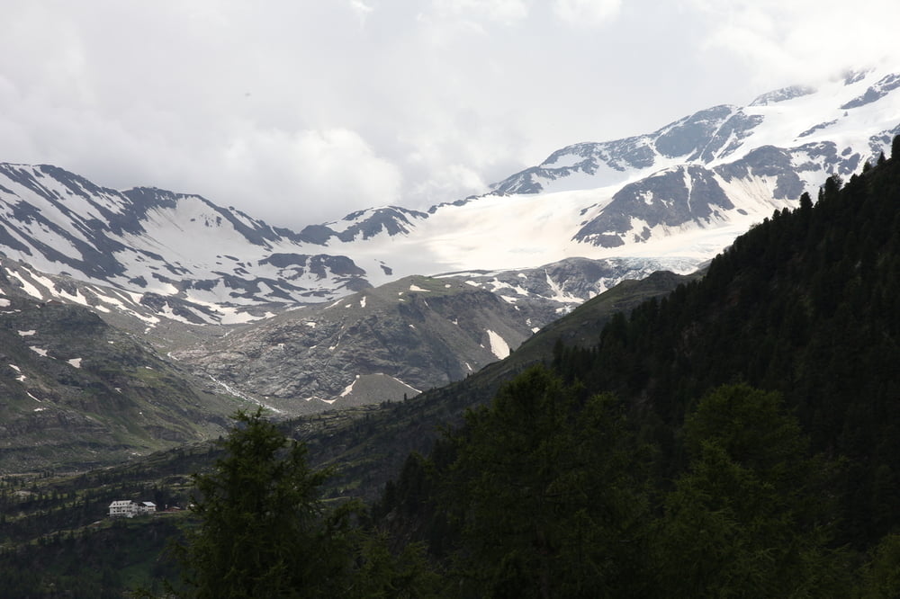
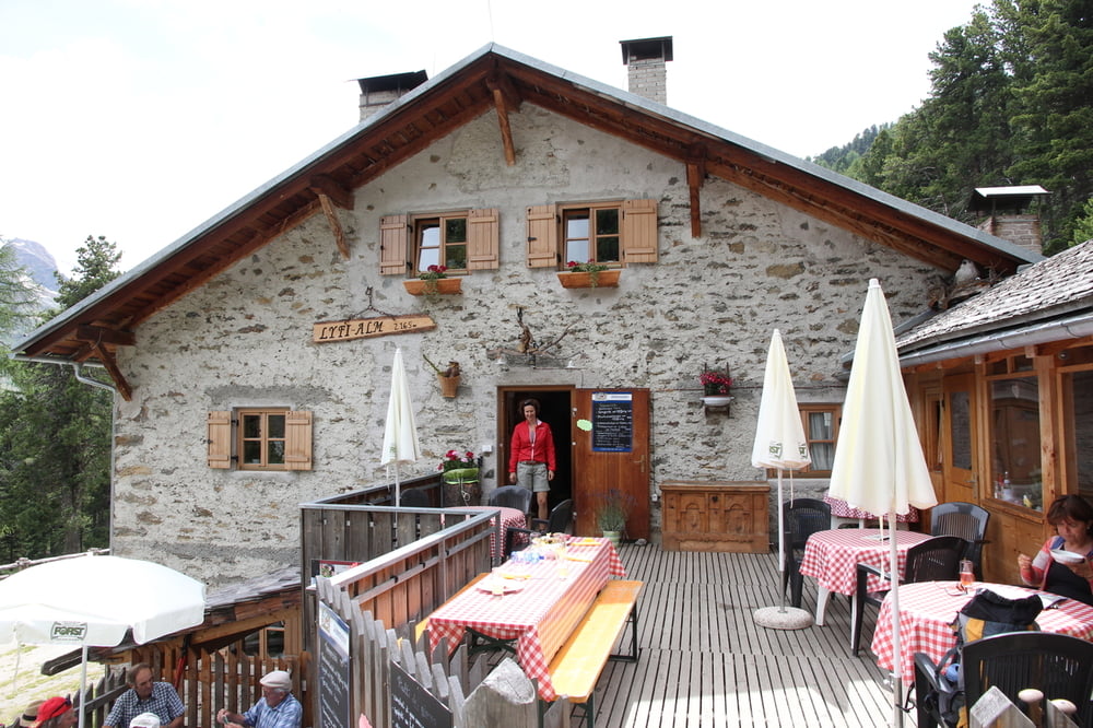
Vom Parkplatz Zufritt überqueren wir die Straße, dort beginnt auf einer kleinen Wiese links über einem Wassertrog der Mulisteig. Von jetzt an geht es mal mehr, mal weniger steigend Richtung Talende, kommen zur Straße, auf der wir zwei kurzen Serpentinen folgend die Abzweigung Lyfiealm erreichen. Hier gehen wir zur Enzian Alm hoch, biegen sofort nach dem Stall links auf den Steig Nr.20 ab. Steigend ziemlich steil bis zum Bach, überqueren die Brücke, kommen zum Steig Nr.35, der uns rechts zur StierAlm, weiter zur Lyfie Alm und wieder zurück zum Zufritthaus führt. Tolle Wanderung, außer den 300-400m Straße und 100m Forstweg nur Pfad. Tolle Aussichten auf Cevedale incl. Zufallferner. Die von mir angegebene Zeit ist incl. Rast an der Stieralm & Einkehr Lyfiealm, reine Gehzeit war 2h30min.
Tour gallery
Tour map and elevation profile
Minimum height 1858 m
Maximum height 2270 m
More about the tour author

|
theduke1mtb |
Comments

Der Straße ins Martelltal folgen, kurz hinter dem Zufritt Stausee auf der linken Seite den Parkplatz benutzen, die geringe Parkgebühr wird für die Instandhaltung der Wege und Rastplätze im Nationalpark verwendet.
GPS tracks
Trackpoints-
GPX / Garmin Map Source (gpx) download
-
TCX / Garmin Training Center® (tcx) download
-
CRS / Garmin Training Center® (crs) download
-
Google Earth (kml) download
-
G7ToWin (g7t) download
-
TTQV (trk) download
-
Overlay (ovl) download
-
Fugawi (txt) download
-
Kompass (DAV) Track (tk) download
-
Track data sheet (pdf) download
-
Original file of the author (gpx) download
More about the tour author
|
|
theduke1mtb |
Add to my favorites
Remove from my favorites
Edit tags
Open track
My score
Rate