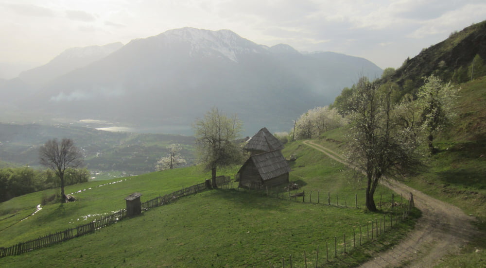
Aussichtsreiche Hausrunde durch Wiesen und Wald. Erinnert an Tirol von vor 50 Jahren.
Rundtour gegen Uhrzeigersinn, 10 Min schieben.
46% Asphalt, 34%Sandstrasse, 12% Karrenweg, 5% Single, 5% Gebüsch.
RAUF:
Vom Hotel Kuladamjanova (empfehlenswerte Kuriosität direkt am See http://www.booking.com/hotel/me/kula-damjanova.de.html) geht’s auf einer Asphaltstrasse Richtung Plav, dann eben kurz in ein Tal rein, dann steiler durch eine Streusiedlung mit Kikeriki, Hendlgegacker und grüßenden Menschen. Es folgt eine eher steile Sandstrasse (15%) durch Wiesen und Obstbäume. Die letzten 50 Hm sind dann auf einem noch steileren Karrenweg (20%), der auf einen Rücken hinaufführt. Hier gibt’s Aussicht auf den See und die umliegenden Berge.
RUNTER:
Kurz ein netter Singletrail (S0-S1), der sich später im Wald und auf der Wiese verliert. Laut Wanderkarte sollte hier ein Weg sein. Ca. 100m lang hab ich ihn nicht gefunden und bin durchs Gebüsch weiter. (Vermutlich verläuft er links vom aufgezeichneten Track.) Danach kommt ein rasanter, griffiger, manchmal mit Anliegern versehener Downhill auf einem Karrenweg. Das letzte Stück wieder Asphalt zurück zum Hotel.
Einkehr: Nur in Plav
Start+Ende: Plav, Hotel Kula Damjanova
Auto: Podgorica – Kolasin – Mojkovac – Berane – Plav
Anmekungen: Singletrail – Schwierigkeitsbewertung: http://www.singletrail-skala.de
Tour gallery
Tour map and elevation profile
Comments

Auto: Podgorica – Kolasin – Mojkovac – Berane – Plav
GPS tracks
Trackpoints-
GPX / Garmin Map Source (gpx) download
-
TCX / Garmin Training Center® (tcx) download
-
CRS / Garmin Training Center® (crs) download
-
Google Earth (kml) download
-
G7ToWin (g7t) download
-
TTQV (trk) download
-
Overlay (ovl) download
-
Fugawi (txt) download
-
Kompass (DAV) Track (tk) download
-
Track data sheet (pdf) download
-
Original file of the author (gpx) download


