Login

Forgotten password?

Cookies have to be accepted!
Your browser's cookie functionality is disabled. Please enable this functionality.

Not a member yet?

Register now
Login

Available for registred users only

Log in to use this feature.

Forgotten password?

Cookies have to be accepted!
Your browser's cookie functionality is disabled. Please enable this functionality.

Not a member yet?

Register now
Filter
Categories
Advanced filters
  • Distance (km)
  • Height
Save filters Reset filter

TrackRank

QRCode

Technical data

Distance8,2 km Height314 m Way down316 m Duration02:49 h:m Date03.04.2016
Scores Author Landscape Fun factor Fitness Technique

Statistics

819 Views Scores 51 Downloads Average
Rate
  • Track data sheet
  • Directions
  • Downloads

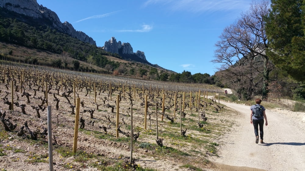
Die Dentelles Sarrazines in dem kleinen Gebirge Montmirail sind eines der Highlights für Wanderungen in diesem Gebiet der Provence. Die weißen Kalkklippen sind umgeben von Weinbergen, Obstwiesen und Pinienwäldern in einem wunderschönen Hügelland.

Auf unser kleinen Wanderung umrundeten wird die Sarazenenzähne auf Feld- und Fahrwegen sowie schmalen, streckenweise steinigen Wanderpfaden. Die Orientierung ist einfach und auch der Wanderweg ist für den ungeübten Wanderer gut begehbar.

Weitere Wanderungen in der Provence:

Gorges du Verdon
Dentelles Sarrasines
Pas du Loup
Brantes am Mont Ventoux
Séquret
Gorges de la Nesque


Further information at

https://de.wikipedia.org/wiki/Dentelles_de_Montmirail

Tour gallery

Tour map and elevation profile

  • Open Street Map
  • Google
Minimum height 253 m Maximum height 476 m Detailed view

More about the tour author

riemchens
Member since 2009

Send private message

Comments

Von Vaison la Romaine auf der D 938 nach Malaucene und dort am Kreisel vor dem Ort  rechts ab nach Suzette. Weiter nach Lafare und dort rechts ab der Beschilderung zu den Dentelles de Montemirail folgen. Am Ende der asphaltierten Straße kann man gut parken.

GPS tracks

Trackpoints
  • GPX / Garmin Map Source (gpx) download
  • TCX / Garmin Training Center® (tcx) download
  • CRS / Garmin Training Center® (crs) download
  • Google Earth (kml) download
  • G7ToWin (g7t) download
  • TTQV (trk) download
  • Overlay (ovl) download
  • Fugawi (txt) download
  • Kompass (DAV) Track (tk) download
  • Track data sheet (pdf) download
  • Original file of the author (gpx) download

More about the tour author

riemchens
Member since 2009

Send private message
Share track
Add to my favorites
Remove from my favorites
Edit tags
My score
Rate
Track: Dentelles de Montmirail
Type: Hiking
Distance: 8,2 km
Evaluated on:
Duration:
Day(s)
Hour(s)
Minute(s)
Score: Landscape Fun factor Fitness Technique