


Birkensee-Runde auch für feuchten Untergrund geeignet
meist auf Forstwegen nach Ludersheim, Winkelhaid, Birnthon, Netzstall
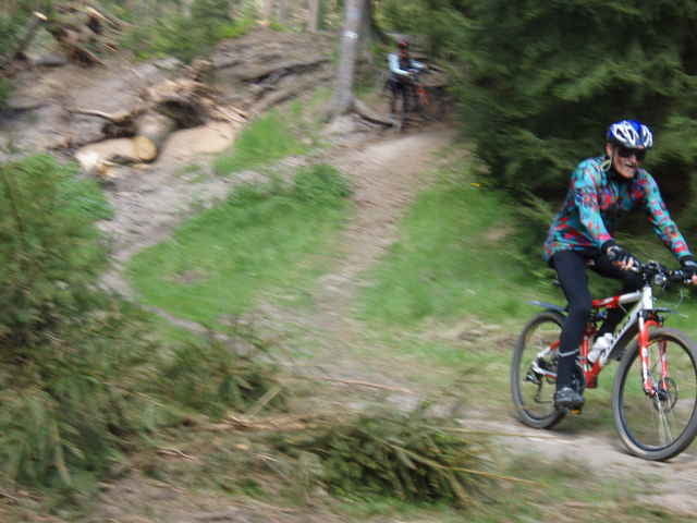
Singletrail am Röthenbach (links) entlang zum Birkensee, Umrundung oder Badeeinlage (auch textilfrei)
Singletrail am Röthenbach (rechts, später links) über Ungelstetten, Oberhaidelbach nach Altdorf zurück.
meist auf Forstwegen nach Ludersheim, Winkelhaid, Birnthon, Netzstall
Singletrail am Röthenbach (links) entlang zum Birkensee, Umrundung oder Badeeinlage (auch textilfrei)
Singletrail am Röthenbach (rechts, später links) über Ungelstetten, Oberhaidelbach nach Altdorf zurück.
Further information at
http://dav-altdorf.de/Bergrad/bergrad.htmTour gallery
Tour map and elevation profile
Minimum height 336 m
Maximum height 482 m
More about the tour author

|
Comments
90518 Altdorf b. Nürnberg, Marktplatzbrunnen (Unterer Markt 1)
Anfahrt über
> BAB A3 AS90 Altdorf-Burgthann
http://maps.google.de/maps?f=d&hl=de&geocode=8478614486286564428,49.408521,11.343622&saddr=49.381926,11.340122&daddr=90518+altdorf,+unterer+Markt+1&mra=pe&mrcr=0&sll=49.395279,11.35334&sspn=0.040835,0.11467&ie=UTF8&ll=49.389385,11.347289&spn=0.04084,0.11467&t=h&z=14
>BAB A6 AS62 Altdorf-Leinburg
http://maps.google.de/maps?f=d&hl=de&geocode=8478614486286564428,49.408521,11.343622&saddr=St2240+%4049.408521,+11.343622&daddr=90518+altdorf,+unterer+Markt+1&mra=pe&mrcr=0&sll=49.38664,11.357819&sspn=0.002553,0.007167&ie=UTF8&ll=49.395279,11.35334&spn=0.040835,0.11467&t=h&z=14
>VGN S-Bahn S2 von Nürnberg
http://vgn.de
GPS tracks
Trackpoints-
GPX / Garmin Map Source (gpx) download
-
TCX / Garmin Training Center® (tcx) download
-
CRS / Garmin Training Center® (crs) download
-
Google Earth (kml) download
-
G7ToWin (g7t) download
-
TTQV (trk) download
-
Overlay (ovl) download
-
Fugawi (txt) download
-
Kompass (DAV) Track (tk) download
-
Track data sheet (pdf) download
-
Original file of the author (gpx) download
More about the tour author
|
|
Add to my favorites
Remove from my favorites
Edit tags
Open track
My score
Rate
SUPER GEIL!
Schön
Nur von Altdorf nach Brunn, westlich des Röthenbachs hätte ich mir etws mehr Trailanteil gewünscht.
Genug scheints im Wald ja zu geben.
Ansonsten eine sehr schöne Tour