
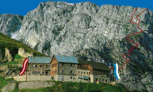

Von der Buchenhöhe zum Purtschellerhaus. Ohne Benutzung der Roßfeld- Straße. Schöne Wanderung durch den Wald bis zur Enzianhütte dann wie Normalweg auf den Eggersattel, über den Satzburger Weg zum Haus. Wahlweise auch über den Bayerischen Weg.
Tour map and elevation profile
Minimum height 984 m
Maximum height 1689 m
More about the tour author
|
|
geierstanger |
Comments

GPS tracks
Trackpoints-
GPX / Garmin Map Source (gpx) download
-
TCX / Garmin Training Center® (tcx) download
-
CRS / Garmin Training Center® (crs) download
-
Google Earth (kml) download
-
G7ToWin (g7t) download
-
TTQV (trk) download
-
Overlay (ovl) download
-
Fugawi (txt) download
-
Kompass (DAV) Track (tk) download
-
Track data sheet (pdf) download
-
Original file of the author (gpx) download
More about the tour author
|
|
geierstanger |
Add to my favorites
Remove from my favorites
Edit tags
Open track
My score
Rate