Login

Forgotten password?

Cookies have to be accepted!
Your browser's cookie functionality is disabled. Please enable this functionality.

Not a member yet?

Register now
Login

Available for registred users only

Log in to use this feature.

Forgotten password?

Cookies have to be accepted!
Your browser's cookie functionality is disabled. Please enable this functionality.

Not a member yet?

Register now
Filter
Categories
Advanced filters
  • Distance (km)
  • Height
Save filters Reset filter

TrackRank

QRCode

Technical data

Distance9,3 km Height730 m Way down711 m Duration04:00 h:m Date23.11.2021
Scores Author Landscape Fun factor Fitness Technique

Statistics

325 Views Scores 21 Downloads Average
Rate
  • Track data sheet
  • Directions
  • Downloads

Einen Teil dieser Tour haben wir hier schon einmal gemacht, hinauf bis zur Kesselalm.

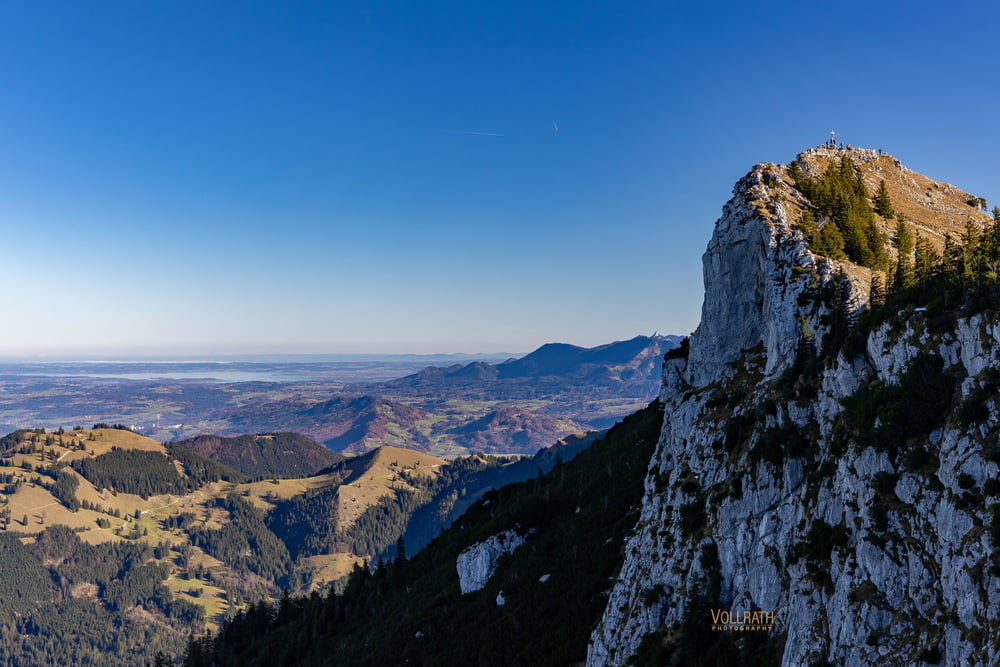
Weiterführend ging es heute hinauf zum Breitenstein.

Es geht meistens via felsigen Wurzelsteig nach oben. Der Gipfel bietet eine bombastische Rundum-Aussicht. Mit dem Kaiserwetter hatten wir wieder einmal viel Glück, stahlblauer Himmel (etwas langeilig für den Fotografen, Wolken sind halt spannender) mit gigantischer Fernsicht und einer konstanten kalten Brise.

Der kurze Abstieg hinunter zum Gipfel des Bockstein ist nicht großartig zu erwähnen. Es waren viele andere Wanderer und Tourengeher unterwegs an diesem Sonntag. Danach ging es noch zum Winkel Stüberl die Bayrisch-Creme Torte und der Kaffee waren wohl verdient. Die Marzipan-Sahne-Tortenstück in seinem opulenten Ausmaß ist einfach paradiesisch :) ;)


Further information at

https://www.vollrath-photography.de/

Tour gallery

Tour map and elevation profile

  • Open Street Map
  • Google
Minimum height 848 m Maximum height 1614 m Detailed view

More about the tour author

Pointer
Member since 2008

Send private message

Comments

In Augsburg startend via A8, A99, A8, Ausfahrt Irschenberg, B 472 und ST2077 nach Fischbachau Birkensteinstrasse, Parken am großen Wandererparkplatz (5,- € Münzen/EC-Karte)

GPS tracks

Trackpoints
  • GPX / Garmin Map Source (gpx) download
  • TCX / Garmin Training Center® (tcx) download
  • CRS / Garmin Training Center® (crs) download
  • Google Earth (kml) download
  • G7ToWin (g7t) download
  • TTQV (trk) download
  • Overlay (ovl) download
  • Fugawi (txt) download
  • Kompass (DAV) Track (tk) download
  • Track data sheet (pdf) download
  • Original file of the author (gpx) download

More about the tour author

Pointer
Member since 2008

Send private message
Share track
Add to my favorites
Remove from my favorites
Edit tags
My score
Rate
Track: Bayerische Voralpen: Breiten- und Bockstein (Rundtour)
Type: Mountain hiking
Distance: 9,3 km
Evaluated on:
Duration:
Day(s)
Hour(s)
Minute(s)
Score: Landscape Fun factor Fitness Technique