


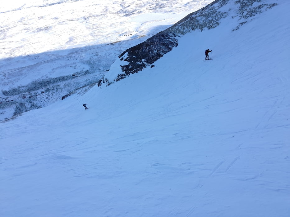
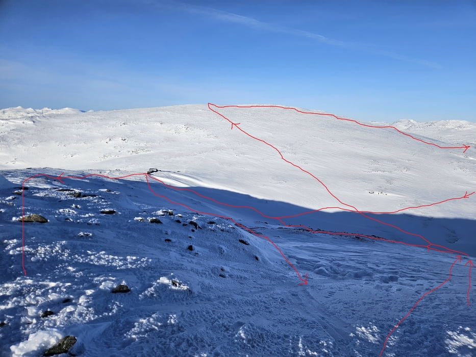
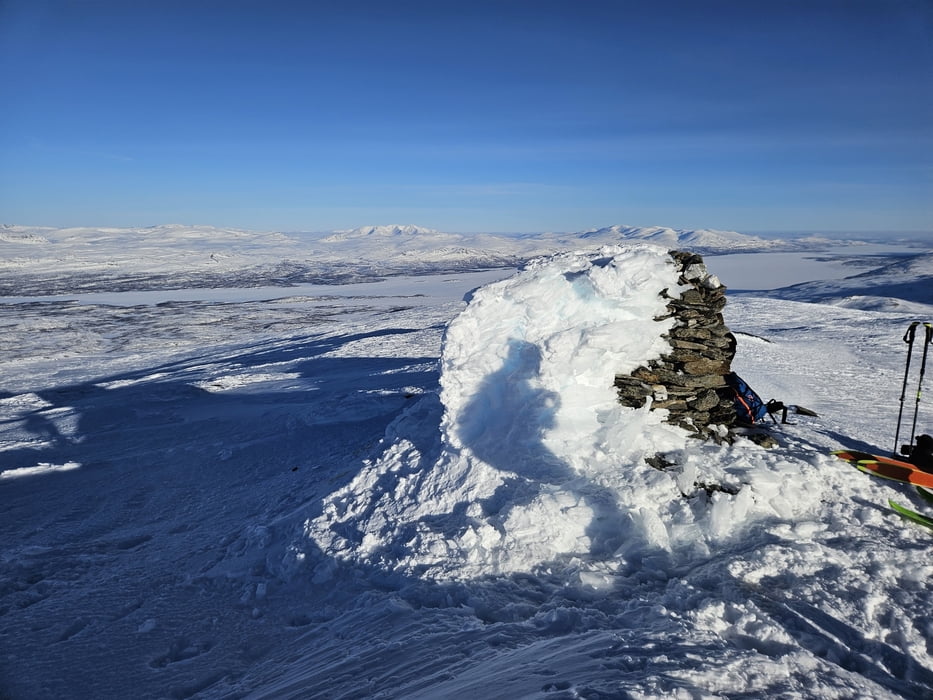
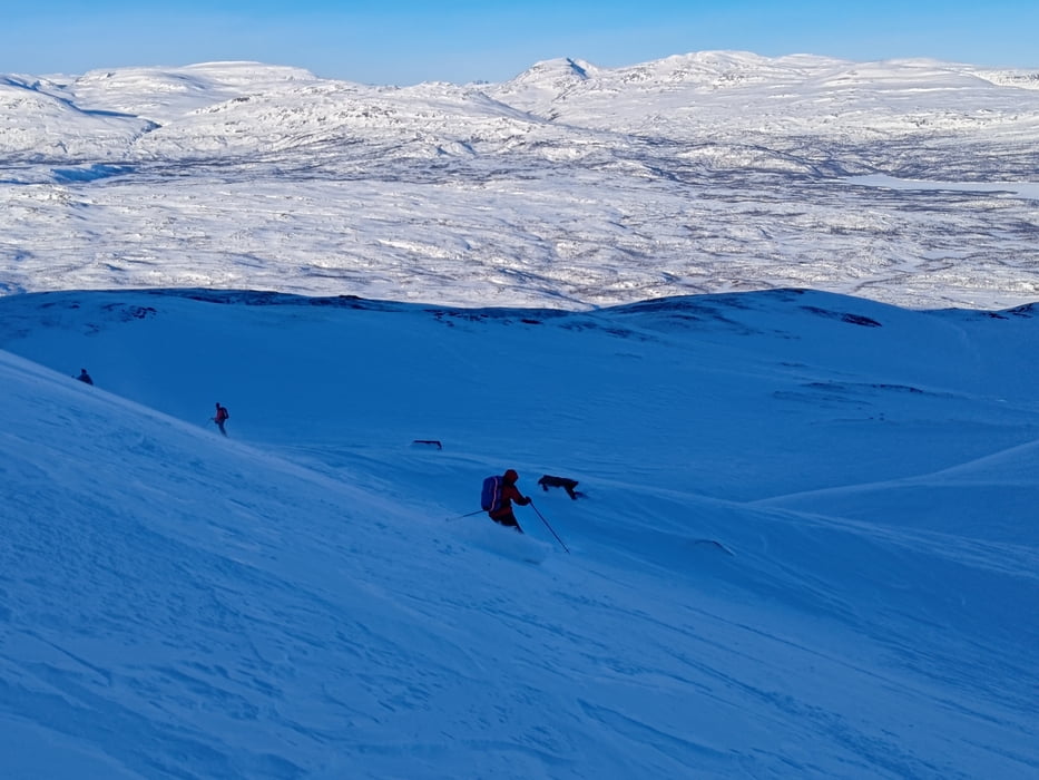
Vom PP an der Bahn an den Häusern vorbei auf die gut erkennbare Rinne zuhalten. Unter Umständen heikel und vereist im Bereich der letzten Sträucher. Dann weiter zuletzt sehr steil (ca. 35°) die Rinne hinauf bis sich das Gelände abflacht. Nun diagonal, nach einer weiteren Scharte nurmehr leicht ansteigend auf das von links kommende Tal zuhalten und dieses hinauf bis zur Laktatjakko Fjällstation (bewirtschaftete Unterkunft, Personentransport mit Pistenraupe). Nun nach Süden dem Kamm entlang zum Kappasaive (Vorgipfel?) mit Steinmann. Abfahrt nach Norden bis das Gelände flacher wird und Aufstieg zur Fiällstation zum Aufwärmen und zur Pause. Nochmaliger Aufstieg in Richtung Kappasaive um den schönen Hang nochmals zu befahren. Dann direkter Aufstieg zum Loktacohkka und Abfahrt über den Ostrücken zur Aufstiegsspur. Im Unteren Teil entlang der Aufstiegsspur zurück zum Auto
Tour gallery
Tour map and elevation profile
Minimum height 463 m
Maximum height 1464 m
More about the tour author

|
Gi |
Comments

Auf der E10 von Abisko in Richtung Ricksgränsen bis nach Kopparasen. Dort die Stichstraße über die Bahn und rechtga am Wendehammer parken
GPS tracks
Trackpoints-
GPX / Garmin Map Source (gpx) download
-
TCX / Garmin Training Center® (tcx) download
-
CRS / Garmin Training Center® (crs) download
-
Google Earth (kml) download
-
G7ToWin (g7t) download
-
TTQV (trk) download
-
Overlay (ovl) download
-
Fugawi (txt) download
-
Kompass (DAV) Track (tk) download
-
Track data sheet (pdf) download
-
Original file of the author (gpx) download
More about the tour author
|
|
Gi |
Add to my favorites
Remove from my favorites
Edit tags
Open track
My score
Rate