

2. Tag: Hergottschnitzerhütte - St. Corona
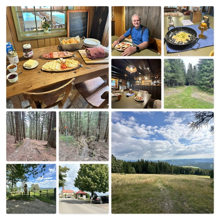
Die Wirtin Marion hat uns ein wundervolles Frühstück bereitet. Dann geht auch schon los und wir wandern den kürzesten Weg nach St. Corona.
Wir folgen dem sehr gut markierten Weg und kreuzen mehrmals den Biketrail.
Anmerkung: Die Wege wurden strikt getrennt. So gibt es nun Single-Trails für Biker und den Wanderweg für die Wanderer; Topo-Karten aktualisieren :)
Bald sehen wir die (ehemalige) Ski-Piste, überqueren diese und folgen dem Wanderweg durch den Wald hinunter zum Orthof.
Das letzte Wegstück ist gleich dem Aufstieg und führt uns zurück zum Parkplatz.
Further information at
https://www.herrgottschnitzerhuette.at/Tour map and elevation profile
Minimum height 854 m
Maximum height 1325 m
More about the tour author
|
|
huberj59 |
Comments

St. Corona ist freundlich zu Autofahren. Es gibt sehr viele und sehr große Parklätze:
Im Ort St. Corona am Wechsel, an den Koordinaten N47° 35' 09.1" E16° 00' 32.9", habe ich geparkt.
Weiters gibt es jedoch mehrere Parkmöglichkeiten beim Gasthof Orthof (Sommerrodelbahn) bzw. beim Lift für die Mountainbiker. Details siehe: Wexl Trails.
GPS tracks
Trackpoints-
GPX / Garmin Map Source (gpx) download
-
TCX / Garmin Training Center® (tcx) download
-
CRS / Garmin Training Center® (crs) download
-
Google Earth (kml) download
-
G7ToWin (g7t) download
-
TTQV (trk) download
-
Overlay (ovl) download
-
Fugawi (txt) download
-
Kompass (DAV) Track (tk) download
-
Track data sheet (pdf) download
-
Original file of the author (gpx) download
More about the tour author
|
|
huberj59 |
Add to my favorites
Remove from my favorites
Edit tags
Open track
My score
Rate