Login

Forgotten password?

Cookies have to be accepted!
Your browser's cookie functionality is disabled. Please enable this functionality.

Not a member yet?

Register now
Login

Available for registred users only

Log in to use this feature.

Forgotten password?

Cookies have to be accepted!
Your browser's cookie functionality is disabled. Please enable this functionality.

Not a member yet?

Register now
Filter
Categories
Advanced filters
  • Distance (km)
  • Height
Save filters Reset filter

TrackRank

QRCode

Technical data

Distance38,4 km Height831 m Way down852 m Duration03:00 h:m Date08.07.2008
Scores Author User Landscape Fun factor Fitness Technique

Statistics

1365 Views 1 Score 270 Downloads 4.00 Average
Rate
  • Track data sheet
  • Directions
  • Downloads

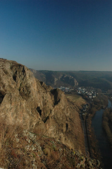
Mittelschwere Mountainbiketour mit hohem Singletrailanteil. Eher leichtere Auffahrten, dafür mittelschwere bis stellenweise schwere Abfahrten. Sehr schöne Aussicht am Rotenfels, der höchsten Steilwand nördlich der Alpen.


Tour map and elevation profile

  • Open Street Map
  • Google
Minimum height 110 m Maximum height 381 m Detailed view

More about the tour author

churchner74
Member since 2008

Send private message

Comments

canyon1 on 07.08.2010

Tourbewertung

Sehr schön ausgewählte Single-Trails in einer tollen Landschaft, hat viel Spaß gemacht! Die Höhenmeterangabe von 638 dürfte aber wohl ein kleiner Druckfehler sein, zumindest zeigt meine Anzeige gut 200 hm mehr an.

Das ist richtig, 638 hm sind zu wenig. Ich habs auf 850 hm korrigiert, dass dürfte in etwa hinkommen.

Von der BAB 61 kommend nach Bad Kreuznach reinfahren, dabei immer in Richtung "Bad Münster-Ebernburg" auf der B 48 halten. Nach durchfahren der Stadtmitte bis zur Nahebrücke fahren, dann entweder vor der Brücke links abbiegen und auf dem Parklpatz-Schwimmbad parken (zeitweise Gebührenpflicht) oder über die Brücke drüber und dort parken (Gebührenfrei).

Start ist der Parkplatz Schwimmbad.

GPS tracks

Trackpoints
  • GPX / Garmin Map Source (gpx) download
  • TCX / Garmin Training Center® (tcx) download
  • CRS / Garmin Training Center® (crs) download
  • Google Earth (kml) download
  • G7ToWin (g7t) download
  • TTQV (trk) download
  • Overlay (ovl) download
  • Fugawi (txt) download
  • Kompass (DAV) Track (tk) download
  • Track data sheet (pdf) download
  • Original file of the author (gpx) download

More about the tour author

churchner74
Member since 2008

Send private message
Share track
Add to my favorites
Remove from my favorites
Edit tags
My score
Rate
Track: 3 Berge Tour
Type: Mountain bike
Distance: 38,4 km
Evaluated on:
Duration:
Day(s)
Hour(s)
Minute(s)
Score: Landscape Fun factor Fitness Technique