

Die Tour ist fast identisch mir der Strecke des Stubaier Bikemarathon, die kleine Route, mit einigen Abänderungen da diese nur für den Marathon frei gegeben werden. Wenn man erst mal oben ist lohnt sich ein Abstecher zur Ochsenalm als Verpflegung. Nach der Sonnensteinalm kommt ein sehr technischer Single Trail Abschnitt, der macht richtig Spass. :o)
Further information at
http://nyx.at/top-six/show_page.php?pid=36Tour gallery


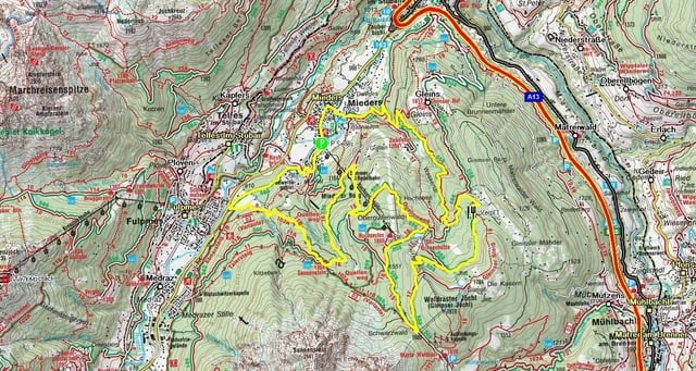
Tour map and elevation profile
Minimum height 914 m
Maximum height 1725 m
More about the tour author
|
|
Kwops |
Comments

Von Innsbruck auf der Brennerautobahn bis zur Ausfahrt Stubaital, rechts bis Mieders Orteingang. Abbiegen zum Serles Lift und hier parken damit der Spass beginnt.
Parken bei N47° 08,908' E011° 23,663'
GPS tracks
Trackpoints-
GPX / Garmin Map Source (gpx) download
-
TCX / Garmin Training Center® (tcx) download
-
CRS / Garmin Training Center® (crs) download
-
Google Earth (kml) download
-
G7ToWin (g7t) download
-
TTQV (trk) download
-
Overlay (ovl) download
-
Fugawi (txt) download
-
Kompass (DAV) Track (tk) download
-
Track data sheet (pdf) download
-
Original file of the author (gpx) download
More about the tour author
|
|
Kwops |
Add to my favorites
Remove from my favorites
Edit tags
Open track
My score
Rate