
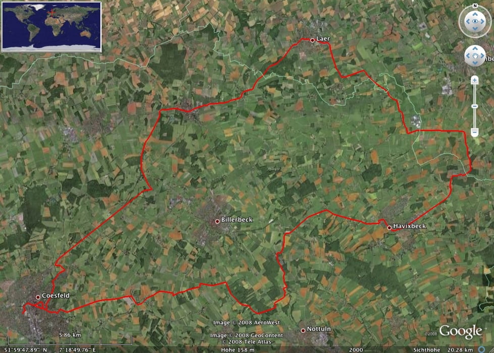

Die Tour ist gut geeignet für Grundlagentraining, da sie nicht so viele Höhenmeter enthält.
Vorsicht ist zwischen Darfeld-Laer geboten. Diese Strecke ist landschaftich wunderschön - es geht durch ein tolles Waldgebiet - doch ist sie für viele Laster ein Autobahn-Zubringer. Insbesonderes auch in den engen Kurven von Laer, sollte man den Verkehr nie aus den Augen lassen.
Von Havixbeck Richtung Billerbeck wird ein Radweg gebaut, der hier auch dringend nötig ist, da viele Autofahrer schnell den Berg herunterkommen. Also auch hier Vorsicht, bis es links ab zum Longinusturm geht. Dann wird es bis COE wieder sehr schön.
Tour map and elevation profile
Minimum height 63 m
Maximum height 159 m
More about the tour author

|
BaronGerd |
Comments

GPS tracks
Trackpoints-
GPX / Garmin Map Source (gpx) download
-
TCX / Garmin Training Center® (tcx) download
-
CRS / Garmin Training Center® (crs) download
-
Google Earth (kml) download
-
G7ToWin (g7t) download
-
TTQV (trk) download
-
Overlay (ovl) download
-
Fugawi (txt) download
-
Kompass (DAV) Track (tk) download
-
Track data sheet (pdf) download
-
Original file of the author (gpx) download
More about the tour author
|
|
BaronGerd |
Add to my favorites
Remove from my favorites
Edit tags
Open track
My score
Rate