

- Am Schloss geht es links Richtung Dilpersried
- Ausgeschildeter Rundweg (auf dem Schild ist ein blauer Turnschuh abgebildet)
- am südlichen Ende den Rundweg verlassen und bergab in Richtung Aach wandern
- Wenn der Bach überquert wurde der Straße folgen, welche direkt zum Schloss zurück führt.
- Die Wanderung verläuft 1/3 auf der Straße und zu 2/3 auf Wanderwegen
Tour gallery

Tour map and elevation profile
Minimum height 573 m
Maximum height 664 m
More about the tour author

|
rödivomsee |
Comments

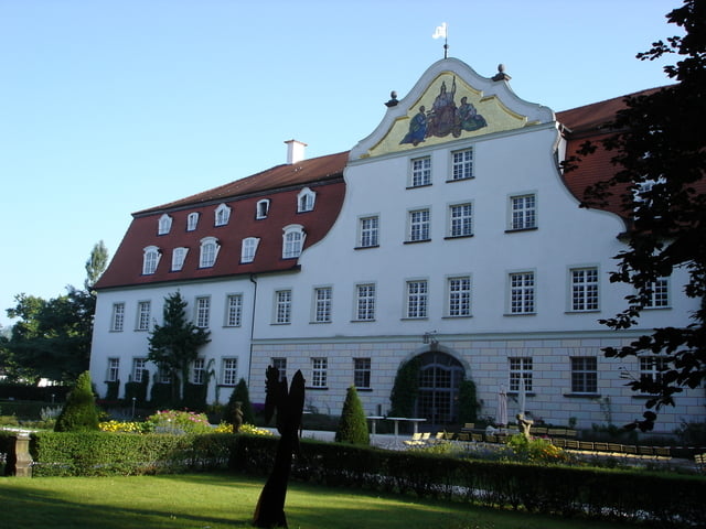
- Die Wanderung beginnt am Schloss Lautrach.
- Lautrach erreicht man über die Autibahn A96 Memmingen-Lindau
- Abfahrt Aitrach
- Beschilderung Richtung Lautrach folgen (5 km)
- In Lautrach der Beschilderung Schloss Lautrach folgen
GPS tracks
Trackpoints-
GPX / Garmin Map Source (gpx) download
-
TCX / Garmin Training Center® (tcx) download
-
CRS / Garmin Training Center® (crs) download
-
Google Earth (kml) download
-
G7ToWin (g7t) download
-
TTQV (trk) download
-
Overlay (ovl) download
-
Fugawi (txt) download
-
Kompass (DAV) Track (tk) download
-
Track data sheet (pdf) download
-
Original file of the author (gpx) download
More about the tour author
|
|
rödivomsee |
Add to my favorites
Remove from my favorites
Edit tags
Open track
My score
Rate