
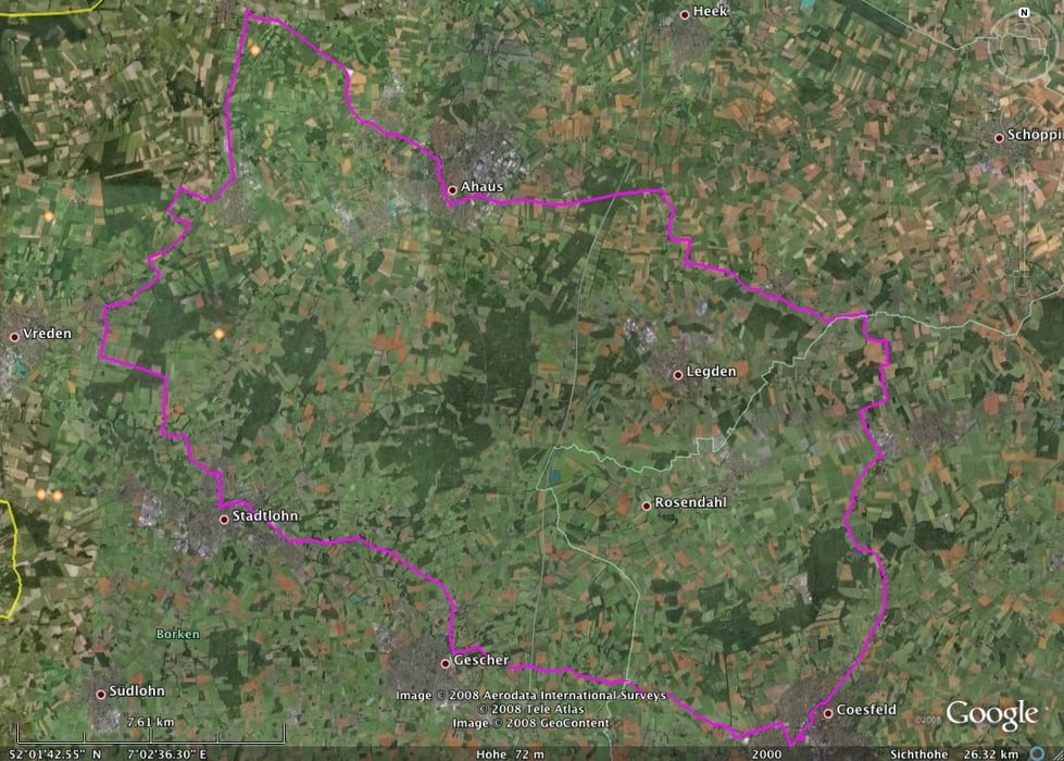

Rennrad-Tour, 82 km von COEsfeld über Gescher-Harwick-Stadtlohn-Vreden-Ottenstein-Alstätte-Wessum-Ahaus-Osterwick nach COE zurück.
Die Strecke ist fast durchgängig sehr gut mit dem Rennrad zu fahren.
Das erste Stück geht von COE über die "Alte Gescheraner" über eine kurvenreiche Strecke. Da diese auch gerne von Motorrad-Fahrern genutzt wird, bin ich erst um 12:00 gestartet - da wird es schlagartig ruhiger. Die Strecke von Harwick (Ziegelei) nach Stadtlohn ist sehr gut mit dem Rennrad befahrbar und hat wenig Verkehr.
Von Ottenstein nach Alstätte sollte man mit dem Rennrad den Radweg meiden, da er sehr viele fiese Huckel enthält. Von Alstätte nach Wessum sollte man ihn dagegen nutzen, da die Autos hier sehr schnell fahren. Auf diesem Stück ist er auch gut befahrbar.
Von Ahaus geht es über eine breite und verkehrsreiche Hauptstraße Richtung Schöppingen. Nach ein paar KM geht es ab Dinkel rechts über Landstrassen weiter. Von da ab sind die Landstraßen und Radwege überwiegend gut. Erst ab der Abzweigung Varlar wird es wieder huckeliger.
Tour map and elevation profile
Minimum height 40 m
Maximum height 108 m
More about the tour author

|
BaronGerd |
Comments

GPS tracks
Trackpoints-
GPX / Garmin Map Source (gpx) download
-
TCX / Garmin Training Center® (tcx) download
-
CRS / Garmin Training Center® (crs) download
-
Google Earth (kml) download
-
G7ToWin (g7t) download
-
TTQV (trk) download
-
Overlay (ovl) download
-
Fugawi (txt) download
-
Kompass (DAV) Track (tk) download
-
Track data sheet (pdf) download
-
Original file of the author (gpx) download
More about the tour author
|
|
BaronGerd |
Add to my favorites
Remove from my favorites
Edit tags
Open track
My score
Rate