Login

Forgotten password?

Cookies have to be accepted!
Your browser's cookie functionality is disabled. Please enable this functionality.

Not a member yet?

Register now
Login

Available for registred users only

Log in to use this feature.

Forgotten password?

Cookies have to be accepted!
Your browser's cookie functionality is disabled. Please enable this functionality.

Not a member yet?

Register now
Filter
Categories
Advanced filters
  • Distance (km)
  • Height
Save filters Reset filter

TrackRank

QRCode

Technical data

Distance208,3 km Height2154 m Way down2171 m Duration08:30 h:m Date14.08.2008
Scores Author Landscape Fun factor Fitness Technique

Statistics

2121 Views Scores 124 Downloads Average
Rate
  • Track data sheet
  • Directions
  • Downloads

Schöne Tour mir einem tollen Panorama.

Der Aufstieg nach Sudelfeld ist sehr schön. Da ich die Tour unter der Woche gefahren bin, war die Auffahrt zum Spitzingsee nicht stark von Autos befahren, ansonsten ist die Hauptstraße zum Spitzingsee recht stark befahren.


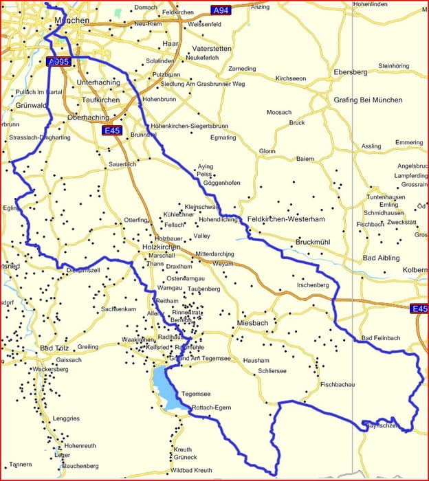
Tour map and elevation profile

  • Open Street Map
  • Google
Minimum height 462 m Maximum height 1127 m Detailed view

More about the tour author

Wiedy
Member since 2008

Send private message

Comments

GPS tracks

Trackpoints
  • GPX / Garmin Map Source (gpx) download
  • TCX / Garmin Training Center® (tcx) download
  • CRS / Garmin Training Center® (crs) download
  • Google Earth (kml) download
  • G7ToWin (g7t) download
  • TTQV (trk) download
  • Overlay (ovl) download
  • Fugawi (txt) download
  • Kompass (DAV) Track (tk) download
  • Track data sheet (pdf) download
  • Original file of the author (gpx) download

More about the tour author

Wiedy
Member since 2008

Send private message
Share track
Add to my favorites
Remove from my favorites
Edit tags
My score
Rate
Track: München - Brannenburg - Sudelfeld - Spitzingsee - Valepp - München
Type: Road biking
Distance: 208,3 km
Evaluated on:
Duration:
Day(s)
Hour(s)
Minute(s)
Score: Landscape Fun factor Fitness Technique