Login

Forgotten password?

Cookies have to be accepted!
Your browser's cookie functionality is disabled. Please enable this functionality.

Not a member yet?

Register now
Login

Available for registred users only

Log in to use this feature.

Forgotten password?

Cookies have to be accepted!
Your browser's cookie functionality is disabled. Please enable this functionality.

Not a member yet?

Register now
Filter
Categories
Advanced filters
  • Distance (km)
  • Height
Save filters Reset filter

TrackRank

QRCode

Technical data

Distance87,4 km Height995 m Way down960 m Duration03:15 h:m Date23.09.2008
Scores Author Landscape Fun factor Fitness Technique

Statistics

972 Views Scores 322 Downloads Average
Rate
  • Track data sheet
  • Directions
  • Downloads

Wir starten in südlicher Richtung über Bibbona auf Welligem Profil weiter bis ca km 25.

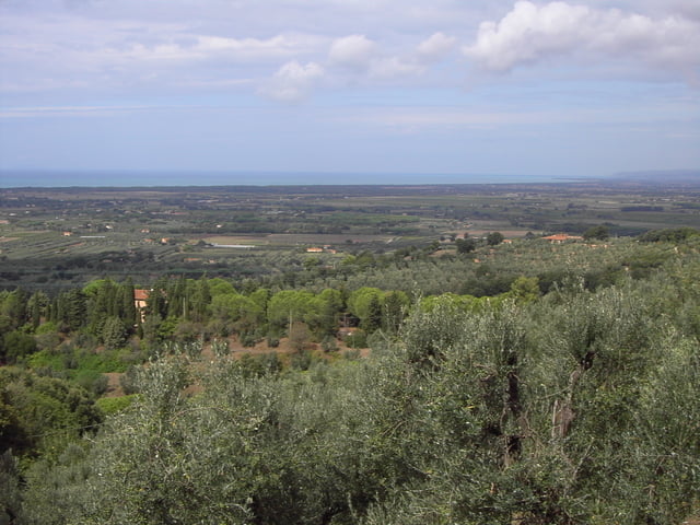
Anschließens folgt die erste Steigung auf fast unbefahrener Straße auf ca. 320m Höhe mit schönem Blick Richtung Meer und Cecina.

Es geht weiter abwärts und folgen der Straße bis wir auf die Sp 329 kommmen. Dort bigen wir nach links ab und fahren bei angenehmer Steigung ca. 5 km weiter. Dort verlassen wir die Sp 329 und halten uns nach Sassetta.

Von nun an geht es wieder bergab und wir folgen dem Track über Canetto -  Casale Marittimo wieder zurück nach Cecina.

Die Runde ist nicht besonders schwer und bietet besonders im ersten drittel der Strecke landschaftliche Schönheiten der Toskana. Diese Runde führt durch eine Gegend, in der viel Wald, Weinreben oder andere typische Gewächse der Toskana zu sehen sind.

Further information at

http://de.wikipedia.org/wiki/Cecina_(Toskana)

Tour gallery

Tour map and elevation profile

  • Open Street Map
  • Google
Minimum height -34 m Maximum height 327 m Detailed view

More about the tour author

höhenreiter
Member since 2007

Send private message

Comments

Cecina liegt ca. 50 km südlich von Pisa oder ca. 100 km südwestlich von Florenz direkt am Meer und ist über Autobahn und Schnellstraße einfach zu erreichen.

GPS tracks

Trackpoints
  • GPX / Garmin Map Source (gpx) download
  • TCX / Garmin Training Center® (tcx) download
  • CRS / Garmin Training Center® (crs) download
  • Google Earth (kml) download
  • G7ToWin (g7t) download
  • TTQV (trk) download
  • Overlay (ovl) download
  • Fugawi (txt) download
  • Kompass (DAV) Track (tk) download
  • Track data sheet (pdf) download
  • Original file of the author (gpx) download

More about the tour author

höhenreiter
Member since 2007

Send private message
Share track
Add to my favorites
Remove from my favorites
Edit tags
My score
Rate
Track: Cecina in südostlicher Richtung
Type: Road biking
Distance: 87,4 km
Evaluated on:
Duration:
Day(s)
Hour(s)
Minute(s)
Score: Landscape Fun factor Fitness Technique