


Eine für den Niederrhein gar nicht so flache Tour.
Von St. Tönis via Kempen/Grefrath geht es über den Höhenzug der Hinsbecker Schweiz Richtung Venlo.
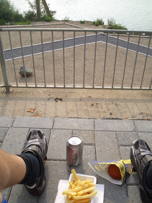
Dort lässt sich prima eine "Fritten spezial" direkt am Ufer der Maas geniessen.
Ganz schnell ist man wieder in Deutschland und kann am Krickenbekcer Schloss wieder über den "Höhenzug" gen Heimat radeln.
Kurzum: ein bischen Urlaubsgefühl ist dabei.
Andere Länder - andere Fritten.
Tour gallery

Tour map and elevation profile
Minimum height 16 m
Maximum height 83 m
More about the tour author

|
tresmocko |
Comments

GPS tracks
Trackpoints-
GPX / Garmin Map Source (gpx) download
-
TCX / Garmin Training Center® (tcx) download
-
CRS / Garmin Training Center® (crs) download
-
Google Earth (kml) download
-
G7ToWin (g7t) download
-
TTQV (trk) download
-
Overlay (ovl) download
-
Fugawi (txt) download
-
Kompass (DAV) Track (tk) download
-
Track data sheet (pdf) download
-
Original file of the author (gpx) download
More about the tour author
|
|
tresmocko |
Add to my favorites
Remove from my favorites
Edit tags
Open track
My score
Rate