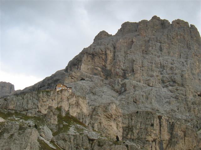
Von Pozza folgen wir kurz der Hauptstr nach Norden bis nach Pera. Dort biegen wir links ab und folgen einer Asphaltstr. bis zum Refugio Gardeccia.
Nach dem Refugio geht es auf einem Schotterweg steil hinauf bis zum höchsten Punkt, dem Refugio Vajolet.
Vor demjenigen der es bis zum Refugio schafft ziehe ich den Hut, der Normalsterbliche muss mit einer kurzen Schiebepassage am Ende rechnen.
Nach der Rast geht es erstmal den Anfahrtsweg zurück runter zum Refugio Gardeccia.
Dieses lassen wir links liegen und fahren auf einem sehr schönen Höhenpfad bis zum Refugio Negritella.
Da biegen wir rechts ab und es geht nun rasant hinunter bis Vigo di Fassa.
In Vigo folgen wir der Asphaltstr bis Pozza.
Fazit: Supertour zwischen beeindruckenden Felswänden.
Tour map and elevation profile
Minimum height 1308 m
Maximum height 2252 m
Comments
Start ist in Pozza di Fassa im Val di Fassa
GPS tracks
Trackpoints-
GPX / Garmin Map Source (gpx) download
-
TCX / Garmin Training Center® (tcx) download
-
CRS / Garmin Training Center® (crs) download
-
Google Earth (kml) download
-
G7ToWin (g7t) download
-
TTQV (trk) download
-
Overlay (ovl) download
-
Fugawi (txt) download
-
Kompass (DAV) Track (tk) download
-
Track data sheet (pdf) download
-
Original file of the author (gpx) download
Add to my favorites
Remove from my favorites
Edit tags
Open track
My score
Rate


Empfehlenswerte Tour