


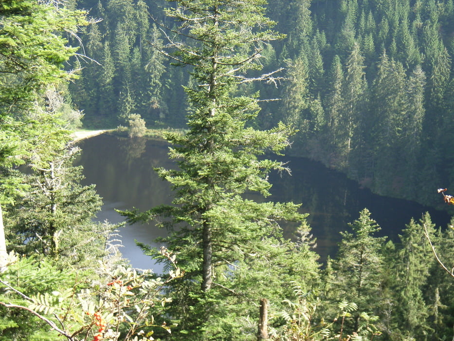
Startpunkt ist das Waldhotel Palmspring. Es folgt der Anstieg Richtung Glaswaldsee. Ein kurzes Stück führt über eine recht unwegsame Strecke, wohl ein verzeichneter Weg der aber nicht mehr gepflegt wird und daher geht man durch dichten Bewuchs und über umgestürzte Bäume. Wer das nicht möchte kann auch einen etwas weiteren Weg außen herum wählen. Sehr idyllisch liegt der Glaswaldsee in einem Talkessel. Weil mit dem Auto nicht zu erreichen hält sich der Tourismus hier in Grenzen. Zurück gehts wieder zum Waldhotel um die Tour angemessen abzuschließen.
Tour gallery
Tour map and elevation profile
Minimum height 140 m
Maximum height 465 m
More about the tour author

|
Bluesbiker |
Comments

A5 bis Ausfahrt Appenweier. Richtung Oberkirch, Oppenau, Bad-Peterstal. Im Ort rechts abbiegen Richtung Schappach. Nach ca. 2 km links abbiegen dem Hinweisschild 'Waldhotel Palmspring' folgend.
GPS tracks
Trackpoints-
GPX / Garmin Map Source (gpx) download
-
TCX / Garmin Training Center® (tcx) download
-
CRS / Garmin Training Center® (crs) download
-
Google Earth (kml) download
-
G7ToWin (g7t) download
-
TTQV (trk) download
-
Overlay (ovl) download
-
Fugawi (txt) download
-
Kompass (DAV) Track (tk) download
-
Track data sheet (pdf) download
-
Original file of the author (gpx) download
More about the tour author
|
|
Bluesbiker |
Add to my favorites
Remove from my favorites
Edit tags
Open track
My score
Rate