Login

Forgotten password?

Cookies have to be accepted!
Your browser's cookie functionality is disabled. Please enable this functionality.

Not a member yet?

Register now
Login

Available for registred users only

Log in to use this feature.

Forgotten password?

Cookies have to be accepted!
Your browser's cookie functionality is disabled. Please enable this functionality.

Not a member yet?

Register now
Filter
Categories
Advanced filters
  • Distance (km)
  • Height
Save filters Reset filter

TrackRank

QRCode

Technical data

Distance10,6 km Height607 m Way down580 m Duration04:00 h:m Date09.11.2008
Scores Author Landscape Fun factor Fitness Technique

Statistics

1550 Views 1 Score 448 Downloads 4.00 Average
Rate
  • Track data sheet
  • Directions
  • Downloads

Von Agulo durch die Rote Wand zum Centro Visitantes und zurück nach Agulo


Diese Tour entspricht der Tour 42 aus dem Rother Wanderführer La Gomera.

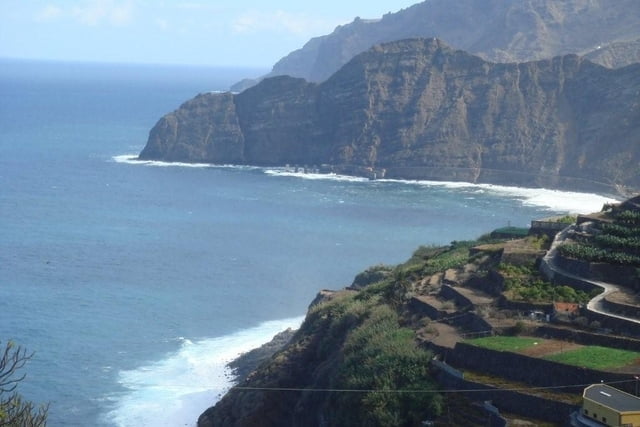
Es handelt sich um eine großartige Wanderung, die zunächst mit einem sehr steilen Anstieg beginnt, dann durch ein Hochtal zum Besucherzentrum führt, bevor es abschließend wieder durch einen schönen Barranco bergab zum Ausgangsort zurückgeht.

Tour gallery

Tour map and elevation profile

  • Open Street Map
  • Google
Minimum height 193 m Maximum height 768 m Detailed view

More about the tour author

jop68
Member since 2008

Send private message

Comments

GPS tracks

Trackpoints
  • GPX / Garmin Map Source (gpx) download
  • TCX / Garmin Training Center® (tcx) download
  • CRS / Garmin Training Center® (crs) download
  • Google Earth (kml) download
  • G7ToWin (g7t) download
  • TTQV (trk) download
  • Overlay (ovl) download
  • Fugawi (txt) download
  • Kompass (DAV) Track (tk) download
  • Track data sheet (pdf) download
  • Original file of the author (gpx) download

More about the tour author

jop68
Member since 2008

Send private message
Share track
Add to my favorites
Remove from my favorites
Edit tags
My score
Rate
Track: Agulo - Rote Wand - Centro de Visitantes - Agulo (Rother Wanderführer Nr.42)
Type: Hiking
Distance: 10,6 km
Evaluated on:
Duration:
Day(s)
Hour(s)
Minute(s)
Score: Landscape Fun factor Fitness Technique