


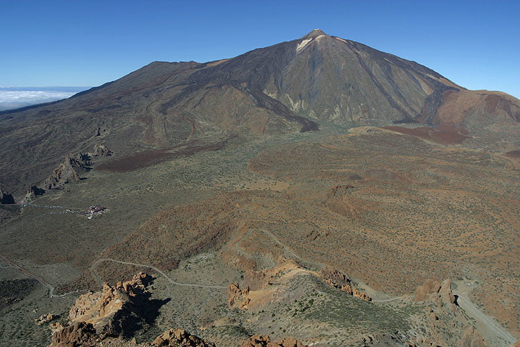
Vom Parkplatz an der Straße geht es erst einmal auf einer Piste entlang. Nach 3,5 km geht es rechts den Hang hinauf. Den Sattel erreicht man nach 4,5 km. Dort geht es wieder rechts weiter. Der Weg wird teilweise recht steil und nach insgesamt 6,5 km erreicht man den Gipfel des Guajara.
Zurück geht es den gleichen Weg.
Zurück geht es den gleichen Weg.
Further information at
http://thogan.de/photography/photos/holidays/teneriffa_2004/guajara/index.htmlTour gallery
Tour map and elevation profile
Minimum height 2125 m
Maximum height 2730 m
More about the tour author

|
Comments
GPS tracks
Trackpoints-
GPX / Garmin Map Source (gpx) download
-
TCX / Garmin Training Center® (tcx) download
-
CRS / Garmin Training Center® (crs) download
-
Google Earth (kml) download
-
G7ToWin (g7t) download
-
TTQV (trk) download
-
Overlay (ovl) download
-
Fugawi (txt) download
-
Kompass (DAV) Track (tk) download
-
Track data sheet (pdf) download
-
Original file of the author (g7t) download
More about the tour author
|
|
Add to my favorites
Remove from my favorites
Edit tags
Open track
My score
Rate
Hinweis
Es gibt auch einen schöneren Weg durch die Lavafelder zum Weg um den Guajara. Auch diesen Teiltrak werde ich thorgan schicken, damit er ihn ggf. in die Tour einbauen kann.
schöner Aufstieg
Steiler anstrengender Weg
der sich lohnt wenn man oben ankommt