Login

Forgotten password?

Cookies have to be accepted!
Your browser's cookie functionality is disabled. Please enable this functionality.

Not a member yet?

Register now
Login

Available for registred users only

Log in to use this feature.

Forgotten password?

Cookies have to be accepted!
Your browser's cookie functionality is disabled. Please enable this functionality.

Not a member yet?

Register now
Filter
Categories
Advanced filters
  • Distance (km)
  • Height
Save filters Reset filter

TrackRank

QRCode

Technical data

Distance6,0 km Height213 m Way down204 m Duration02:30 h:m Date25.12.2008
Scores Author Landscape Fun factor Fitness Technique

Statistics

749 Views Scores 321 Downloads Average
Rate
  • Track data sheet
  • Directions
  • Downloads

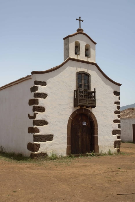
Leichte Wanderung im Norden von La Palma. Ohne Track nur mit der Beschreibung des Rother-Wanderführer nicht immer eindeutig. Einsam keine Einkehrmöglichkeit. An der Eremita Rastplatz.

Tour gallery

Tour map and elevation profile

  • Open Street Map
  • Google
Minimum height 840 m Maximum height 994 m Detailed view

More about the tour author

Banderolo
Member since 2008

Send private message

Comments

Parkplatz am Centro de Visitantes.

GPS tracks

Trackpoints
  • GPX / Garmin Map Source (gpx) download
  • TCX / Garmin Training Center® (tcx) download
  • CRS / Garmin Training Center® (crs) download
  • Google Earth (kml) download
  • G7ToWin (g7t) download
  • TTQV (trk) download
  • Overlay (ovl) download
  • Fugawi (txt) download
  • Kompass (DAV) Track (tk) download
  • Track data sheet (pdf) download
  • Original file of the author (gpx) download

More about the tour author

Banderolo
Member since 2008

Send private message
Share track
Add to my favorites
Remove from my favorites
Edit tags
My score
Rate
Track: Wanderung Rother 24 Rundweg
Type: Hiking
Distance: 6,0 km
Evaluated on:
Duration:
Day(s)
Hour(s)
Minute(s)
Score: Landscape Fun factor Fitness Technique