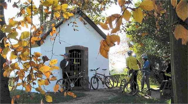
Diese Tour führt den "mittleren" Saarländer oder Gäste aus dem "Reich" ins nördliche Saarland. Bis auf wenige Trails bewegen wir uns meist auf Feld- und Waldwegen.
Stationen und Sehenswürdigkeiten:
Golfplatz Weiherhof
Dellborner Mühle
Buchheimer Kapellchen (ab hier langer Ansteig)
Erlebnispark Rappweiler
Zwei-Täler-Weg (Wanderwege/Singletrails)
Kurzentrum Weiskirchen
Thailener Wald
Die Tour eignet sich gut als gemütliche Sonntagsrunde...
Stationen und Sehenswürdigkeiten:
Golfplatz Weiherhof
Dellborner Mühle
Buchheimer Kapellchen (ab hier langer Ansteig)
Erlebnispark Rappweiler
Zwei-Täler-Weg (Wanderwege/Singletrails)
Kurzentrum Weiskirchen
Thailener Wald
Die Tour eignet sich gut als gemütliche Sonntagsrunde...
Further information at
http://www.nmbiking.deTour gallery
Tour map and elevation profile
Minimum height 195 m
Maximum height 493 m
Comments
Start: Michelbach
B 268 durch Schmelz durch, abbiegen in den Ort, an der ehemaligen Grundschule vorbei raus aus dem ort bis zum Waldrand - oder
Start: Golfplatz Weiherhof, Nunkirchen
B 268 durch Schmelz durch, abbiegen in den Ort, an der ehemaligen Grundschule vorbei raus aus dem ort bis zum Waldrand - oder
Start: Golfplatz Weiherhof, Nunkirchen
GPS tracks
Trackpoints-
GPX / Garmin Map Source (gpx) download
-
TCX / Garmin Training Center® (tcx) download
-
CRS / Garmin Training Center® (crs) download
-
Google Earth (kml) download
-
G7ToWin (g7t) download
-
TTQV (trk) download
-
Overlay (ovl) download
-
Fugawi (txt) download
-
Kompass (DAV) Track (tk) download
-
Track data sheet (pdf) download
-
Original file of the author (g7t) download
Add to my favorites
Remove from my favorites
Edit tags
Open track
My score
Rate


Karte
habe wie du vorgeschlagen mir mal die Seiten angeschaut. Sehr interessant, allerdings sieht man bei der Karte von mapquest nur die Hauptstrassen, aber keine Feldwege. Gibt es hierzu auch in einer anderen Plattform im Internet Kartenmaterial.
Danke für Nachricht
Gruß
Klaus