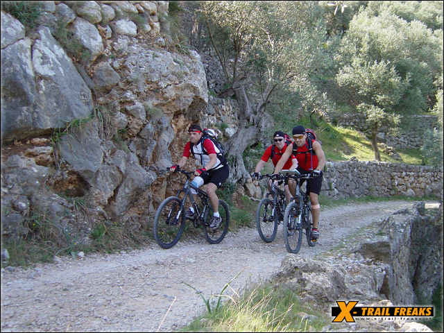
Wir fahren entlang der Strandpromenade von Port de Soller in Richtung Hafen. Die letzte, größere, asphaltierte Straße geht rechts hoch in Richtung "Coll de s'Illa". Bei "Ca's America" haben wir einen tollen Ausblick auf den Hafen von Port de Soller.Die befestigte Strasse mündet in ein Offroadterrain. Ein einfacher, gut zu befahrender Schotterweg entlang des Küstenhochplateaus bietet uns herrliche Blicke über den Meereshorizont. Auf Höhe der kleinen Insel "s'Illeta" beginnt ein Wanderweg bzw. Singletrail, auf welchem die Räder teilweise getragen werden müssen. Beim "Font des Joncar" ist das Ende der Bikestrecke erreicht. Hinunter zur Quelle nur zu Fuß und ohne Bike möglich. Der Weg über den Pass "Pas de s'Heura" ins benachbarte Balitxtal ist leider mit dem Rad nicht befahrbar. Retour auf der gleichen Strecke und hoch zum Wehrturm "Torre Picada". Ein beeindruckender Rundblick bringt uns zurück ins Seefahrerjahrhundert.
Further information at
http://www.x-trail-freaks.atTour gallery
Tour map and elevation profile
Minimum height -1 m
Maximum height 196 m
Comments

Hotel Brisas. Das Hotel Brisas liegt am Ortsrand von Puerto de Sóller an der "Playa d´en Repic".
GPS tracks
Trackpoints-
GPX / Garmin Map Source (gpx) download
-
TCX / Garmin Training Center® (tcx) download
-
CRS / Garmin Training Center® (crs) download
-
Google Earth (kml) download
-
G7ToWin (g7t) download
-
TTQV (trk) download
-
Overlay (ovl) download
-
Fugawi (txt) download
-
Kompass (DAV) Track (tk) download
-
Track data sheet (pdf) download
-
Original file of the author (gpx) download
Add to my favorites
Remove from my favorites
Edit tags
Open track
My score
Rate


