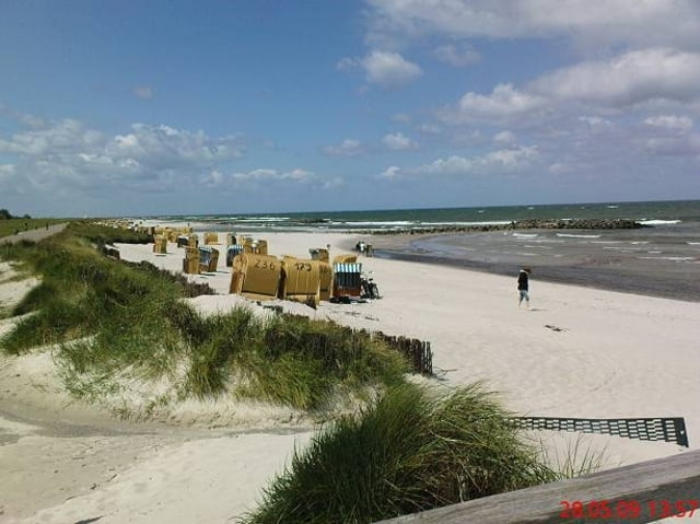
Da es sich um eine Rundtour handelt, kann an jedem Punkt in die Tour eingestiegen werden.
Empfehlen würde ich ein Mountain- bzw. ein gutes Trekkingbike, da es je nach Witterung an ein paar wenigen Stellen doch etwas schwerer werden kann.
Landschaftlich hat diese Tour einiges zu bieten: Kilometerweit geht es am Ostseestrand entlang, vorbei an Orten wie Kalifornien oder Brasilien. Der Hessenstein bildet den Gipfelpunkt der Tour und am Plöner See kann man weitere Eindrücke in sich aufsaugen.
Mit etwas Kondition ausgestattet ist es eine schöne Tagestour und ganz nebenbei kommen schon ein paar beachtliche Höhenmeter zusammen.
Viel Spass wünscht
Magic21
Tour gallery
Tour map and elevation profile
Comments
GPS tracks
Trackpoints-
GPX / Garmin Map Source (gpx) download
-
TCX / Garmin Training Center® (tcx) download
-
CRS / Garmin Training Center® (crs) download
-
Google Earth (kml) download
-
G7ToWin (g7t) download
-
TTQV (trk) download
-
Overlay (ovl) download
-
Fugawi (txt) download
-
Kompass (DAV) Track (tk) download
-
Track data sheet (pdf) download
-
Original file of the author (gpx) download


Muß man gefahren sein!
das ist mal eine Supertour!! Sehr gut ausgearbeitet und von Allem was dabei! Im dunklen Wald einmal ein kurzes Stück ohne Weg und das bei strömendem Regen: da muß man sich auf den kleinen Zauberkasten verlassen.
Vielen Dank an den Ersteller der Tour!
Gruß Kurbelmaxe
101km
es ist eine sehr schöne Tagestour. Von allem was dabei. Mir hat die Tour heute viel Spaß gebracht.
Gruß Scharon73