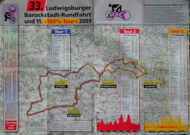
Die 80 km Runde ist ein Teilstück der 125 km Runde, die es hier auch schon als Tour gibt. An einigen Stellen weicht die 2009er Strecke etwas von der alten ab.
Sie ist sehr schön zu fahren. Die Steigungen sind alle moderat und man hat am Ende doch über 800 Höhenmeter zusammen.
Further information at
http://www.rsc-komet.deTour map and elevation profile
Minimum height 176 m
Maximum height 363 m
Comments
Autobahnausfahrt Ludwigsburg Nord, dann auf der B27 Richtung Ludwigsburg. Nach dem Ortsschild an der Kreuzung (auf der linken Seite ist der Zweirad Bommer) links abbiegen (Monreposstr.), 2. rechts (Straßenäcker), nächste links (Bönnigheimer) bis ans Ende zu den Sportanlagen.
GPS tracks
Trackpoints-
GPX / Garmin Map Source (gpx) download
-
TCX / Garmin Training Center® (tcx) download
-
CRS / Garmin Training Center® (crs) download
-
Google Earth (kml) download
-
G7ToWin (g7t) download
-
TTQV (trk) download
-
Overlay (ovl) download
-
Fugawi (txt) download
-
Kompass (DAV) Track (tk) download
-
Track data sheet (pdf) download
-
Original file of the author (gpx) download
Add to my favorites
Remove from my favorites
Edit tags
Open track
My score
Rate


schöne Runde
nicht empfehlenswert