


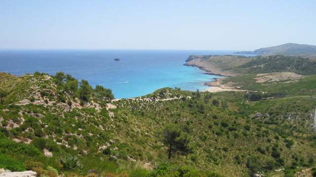
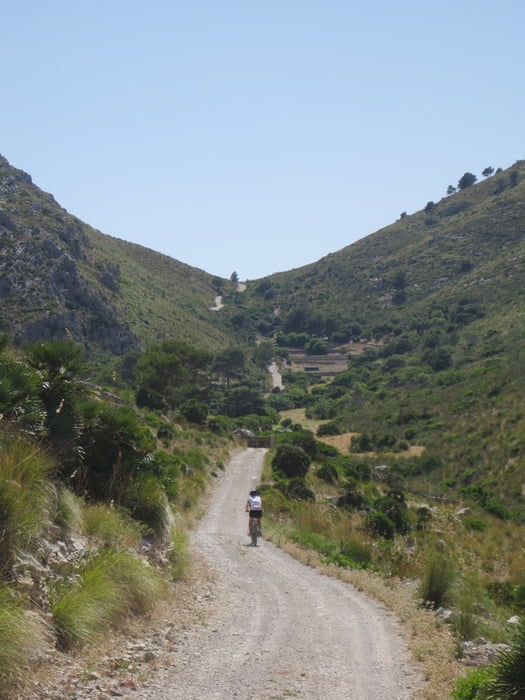
Tour gallery
Tour map and elevation profile
Minimum height -7 m
Maximum height 587 m
More about the tour author

|
jscheib |
Comments
Von Palma über die C715 nach Arta, dann in Richtung "ermita de betlem" halten. Am Parkplatz unterhalb der Burg ("Castell Sani Salvador") geht's los.
GPS tracks
Trackpoints-
GPX / Garmin Map Source (gpx) download
-
TCX / Garmin Training Center® (tcx) download
-
CRS / Garmin Training Center® (crs) download
-
Google Earth (kml) download
-
G7ToWin (g7t) download
-
TTQV (trk) download
-
Overlay (ovl) download
-
Fugawi (txt) download
-
Kompass (DAV) Track (tk) download
-
Track data sheet (pdf) download
-
Original file of the author (gpx) download
More about the tour author
|
|
jscheib |
Add to my favorites
Remove from my favorites
Edit tags
Open track
My score
Rate
Tourenbeschreibung
Anfangs über eine ruhige leicht ansteigende Landstaße, dann nach ein paar Km über Feldwege (sehr grober Schotter) und dann nach dem Antennenberg "Sa Todossa" über einen Wanderpfad direkt zur Badebucht. Später dann wieder über Feldwege in toller abwechslungsreicher Vegetation zurück zum Ausgangspunkt.
Achtung!!
Die Tour verläuft ausschließlich in freien Gelände! An sehr heißen Tagen genügend Wasser und Sonnencreme einpacken!
Viel Spaß beim Biken