
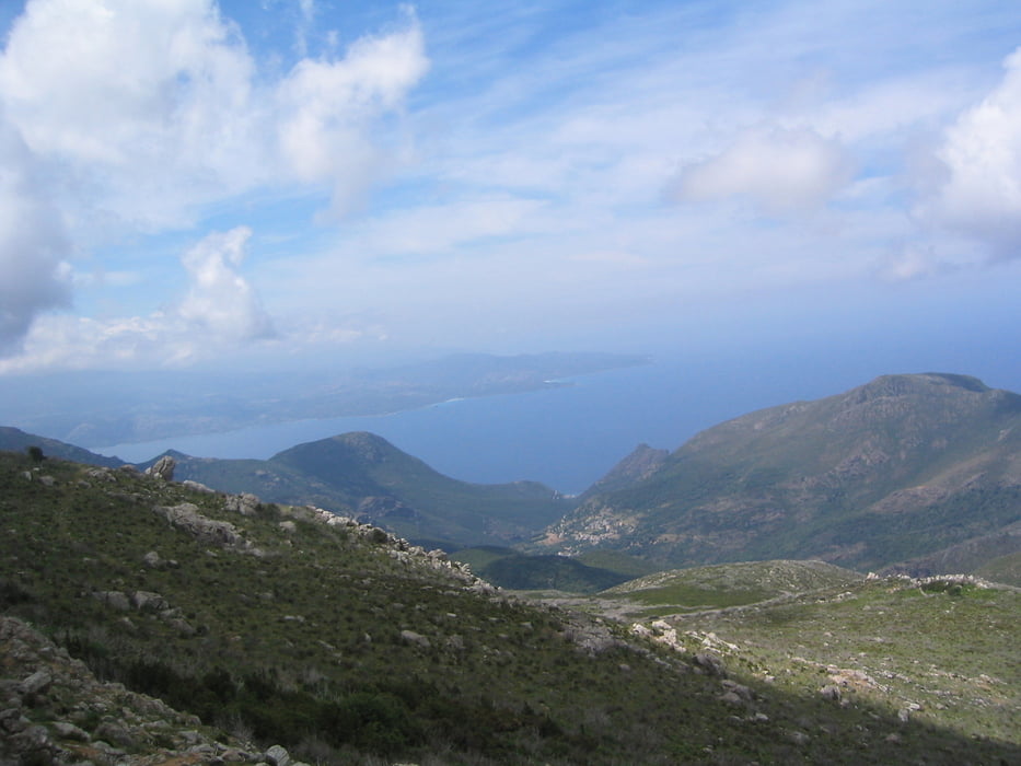

Anstrengende, aber lohnenswerte Wanderung auf den 2.höchsten Berg am Cap, der aber genau deshalb eine wunderschöne Rundsicht über den nördlichsten Abschnitt der tollen Mittelmeerinsel bietet. Während des Aufstiegs sahen wir an einem Bach orangene Lilien blühen, neben denen sich das Wasser in einer kleinen Badegumpe sammelte. Kalt, aber sehr erfrischend
Der Wanderpfad besteht überwiegend aus groben Steinen und Geröll. Da wenig Schatten und die Maccia zusätzlich Wärme speichert und abgibt, sollte die Tour im Hochsommer sehr früh und mit guten Wanderschuhen angegangen werden.
Und kein Witz: eine Mahntafel errinert daran, dass im März vor 2 Jahren eine Frau kurz unterhalb des Stello noch erfroren ist.
Tour map and elevation profile
Minimum height 235 m
Maximum height 1312 m
More about the tour author

|
Guddy |
Comments

GPS tracks
Trackpoints-
GPX / Garmin Map Source (gpx) download
-
TCX / Garmin Training Center® (tcx) download
-
CRS / Garmin Training Center® (crs) download
-
Google Earth (kml) download
-
G7ToWin (g7t) download
-
TTQV (trk) download
-
Overlay (ovl) download
-
Fugawi (txt) download
-
Kompass (DAV) Track (tk) download
-
Track data sheet (pdf) download
-
Original file of the author (gpx) download
More about the tour author
|
|
Guddy |
Add to my favorites
Remove from my favorites
Edit tags
Open track
My score
Rate