Login

Forgotten password?

Cookies have to be accepted!
Your browser's cookie functionality is disabled. Please enable this functionality.

Not a member yet?

Register now
Login

Available for registred users only

Log in to use this feature.

Forgotten password?

Cookies have to be accepted!
Your browser's cookie functionality is disabled. Please enable this functionality.

Not a member yet?

Register now
Filter
Categories
Advanced filters
  • Distance (km)
  • Height
Save filters Reset filter

TrackRank

QRCode

Technical data

Distance11,9 km Height351 m Way down372 m Duration02:50 h:m Date05.07.2009
Scores Author Landscape Fun factor Fitness Technique

Statistics

2480 Views Scores 224 Downloads Average
Rate
  • Track data sheet
  • Directions
  • Downloads
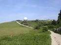
Dir Tour startet an der Fuldaquelle und führt über die Wasserkuppe hinuter zum Heckenhöfchen (Gaststätte). Weiter geht es zum Guckaisee (Badesee nit Gaststätte), von dort ein steiler Anstieg zurück zur Fuldaquelle, wo man einen kühlen Schluck nehmen kann.

Tour map and elevation profile

  • Open Street Map
  • Google
Minimum height 621 m Maximum height 922 m Detailed view

More about the tour author

Hillclimber
Member since 2009

Send private message

Comments

GPS tracks

Trackpoints
  • GPX / Garmin Map Source (gpx) download
  • TCX / Garmin Training Center® (tcx) download
  • CRS / Garmin Training Center® (crs) download
  • Google Earth (kml) download
  • G7ToWin (g7t) download
  • TTQV (trk) download
  • Overlay (ovl) download
  • Fugawi (txt) download
  • Kompass (DAV) Track (tk) download
  • Track data sheet (pdf) download
  • Original file of the author (gpx) download

More about the tour author

Hillclimber
Member since 2009

Send private message
Share track
Add to my favorites
Remove from my favorites
Edit tags
My score
Rate
Track: Fuldaquelle/Wasserkuppe/Guckaisee
Type: Hiking
Distance: 11,9 km
Evaluated on:
Duration:
Day(s)
Hour(s)
Minute(s)
Score: Landscape Fun factor Fitness Technique