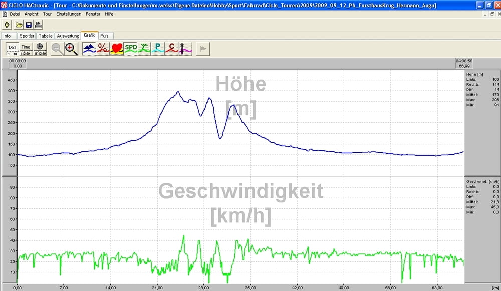
Nach eine Aspahltanfahrt geht's bald weg von der Strasse vorbei an Bad Lippspringe und Schlangen, bevor man "aufeinmal" das Forsthaus unterhalb der Gausekoete erreicht. Der folgende Anstieg war frueher ein schoener, sandiger Weg, der mittlerweile mit teilweise grossen Bruchsteinen "gepflastert" ist. (Diesen Weg als Abfahrt genommen und man ist kraeftig durchgeschuettelt.) Nach zwei weiteren Wellen kommt man am Hermannsdenkmal an, wo man sich auf eine schoene, steile Abfahrt freuen kann. Wenn man die Region kennt, kann man allerdings auch einen breiteren und nicht so steilen Weg waehlen.
Nach dem Forsthaus kommt nochmal eine Asphaltauffahrt, bevor es dann im Bogen weiter um den noerdlichen Teil der Senne geht. Man faehrt durch das Furlbachtal http://de.wikipedia.org/wiki/Furlbachtal , bei Augustdorf und ein wenig spaeter an den Emsquellen vorbei http://de.wikipedia.org/wiki/Ems
Danach heisst. Auf seichter Ebene zurueck nach Hause.
Further information at
http://www.paderborner-land.de/Tour gallery
Tour map and elevation profile
Comments
GPS tracks
Trackpoints-
GPX / Garmin Map Source (gpx) download
-
TCX / Garmin Training Center® (tcx) download
-
CRS / Garmin Training Center® (crs) download
-
Google Earth (kml) download
-
G7ToWin (g7t) download
-
TTQV (trk) download
-
Overlay (ovl) download
-
Fugawi (txt) download
-
Kompass (DAV) Track (tk) download
-
Track data sheet (pdf) download
-
Original file of the author (gpx) download


Asphalt-Tour