


Einstieg in diese ca. 18 km lange Extratour kann sein der Parkplatz Stallberg an der Straße von Hünfeld nach Rasdorf oder der Parkplatz am Ortsrand von Großentaft.
Kleinere Berge - Rückersberg; Appelsberg; Stallberg; Moorsberg; Gehilfersberg und Kleinberg sind einige der Berge die das sogenannte Kegelspiel bilden nach dem diese Tour benannt ist.
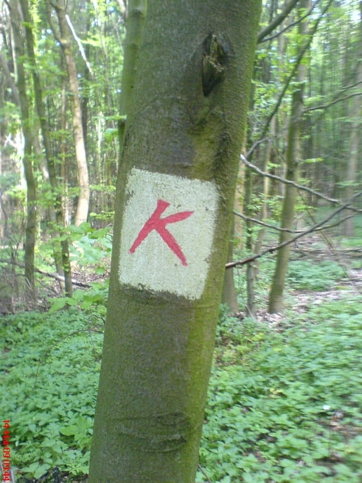
Wie alle Extratouren ist auch diese gut gekennzeichnet (rotes "K").
Einkehrmöglichkeiten in in Rasdorf und Großentaft.
Tour gallery
Tour map and elevation profile
Minimum height 303 m
Maximum height 495 m
More about the tour author
|
|
oboe-kg |
Comments

GPS tracks
Trackpoints-
GPX / Garmin Map Source (gpx) download
-
TCX / Garmin Training Center® (tcx) download
-
CRS / Garmin Training Center® (crs) download
-
Google Earth (kml) download
-
G7ToWin (g7t) download
-
TTQV (trk) download
-
Overlay (ovl) download
-
Fugawi (txt) download
-
Kompass (DAV) Track (tk) download
-
Track data sheet (pdf) download
-
Original file of the author (gpx) download
More about the tour author
|
|
oboe-kg |
Add to my favorites
Remove from my favorites
Edit tags
Open track
My score
Rate