


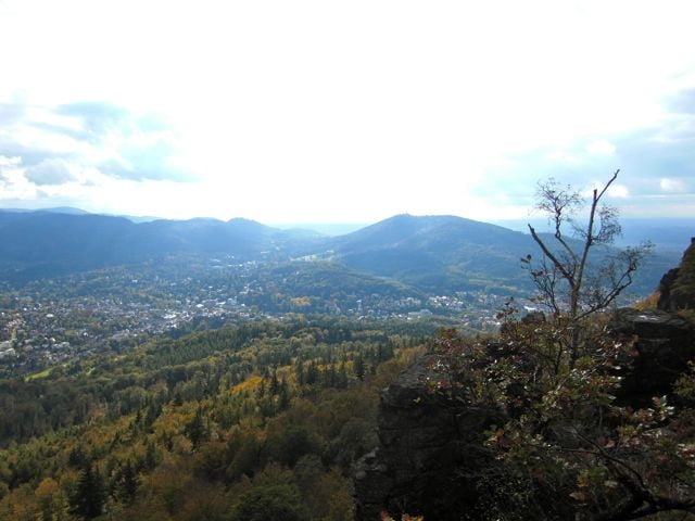
Der eigentliche Tour beginnt in Kuppenheim und endet in Ottenau. Wir hatten gut 10 Km Anfahrt. Es geht stetig Berg auf auf gut fahrbare Forstwege. Ab Kellerskreuz wird's steil bis zur Ruine Hohenbaden. Wir sind weiter auf eine wunderbare Trail an den Felsen entlang um dann wieder steil berg auf bis zum Summit. Mann hat ein sehr schöne blick ins Tal und auf Baden Baden.
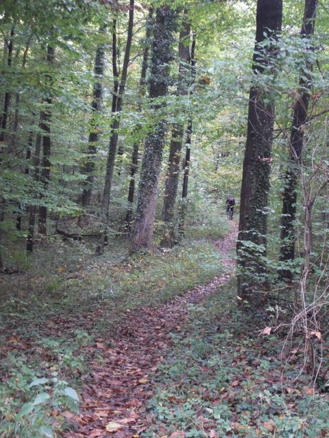
Der Weg runter nach Ottenau fuhr über viele Single-Trails der eine schöne als die andere. Das war ein sehr schöne Tour für ein Herbst-Nachmittag. Leider ging uns die Licht aus - sonst wären wir weiter gefahren.
Tour gallery
Tour map and elevation profile
Minimum height 111 m
Maximum height 574 m
More about the tour author
|
|
OzJeff |
Comments

GPS tracks
Trackpoints-
GPX / Garmin Map Source (gpx) download
-
TCX / Garmin Training Center® (tcx) download
-
CRS / Garmin Training Center® (crs) download
-
Google Earth (kml) download
-
G7ToWin (g7t) download
-
TTQV (trk) download
-
Overlay (ovl) download
-
Fugawi (txt) download
-
Kompass (DAV) Track (tk) download
-
Track data sheet (pdf) download
-
Original file of the author (gpx) download
More about the tour author
|
|
OzJeff |
Add to my favorites
Remove from my favorites
Edit tags
Open track
My score
Rate