Login

Forgotten password?

Cookies have to be accepted!
Your browser's cookie functionality is disabled. Please enable this functionality.

Not a member yet?

Register now
Login

Available for registred users only

Log in to use this feature.

Forgotten password?

Cookies have to be accepted!
Your browser's cookie functionality is disabled. Please enable this functionality.

Not a member yet?

Register now
Filter
Categories
Advanced filters
  • Distance (km)
  • Height
Save filters Reset filter

TrackRank

QRCode

Technical data

Distance10,4 km Height454 m Way down437 m Duration03:41 h:m Date13.11.2009
Scores Author Landscape Fun factor Fitness Technique

Statistics

948 Views Scores 36 Downloads Average
Rate
  • Track data sheet
  • Directions
  • Downloads

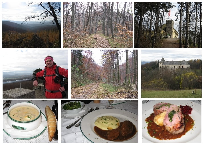
Start war beim Gasthaus Stockerwirt.

Der Markierung folgend gehts auf den steilen Sulzberg und über die Josef-Schöffel-Hütte (am Skilift und imposanten Felsen vorbei) zur Josefswarte und dem Höllsteinhaus. An der Grenze des Naturpark Sparbach entlang (in Sichtweite und leicht erreichbar ist die Ruine Johannstein) erreichen wir den Höppelberg.

In diesem Bereich war der von uns gewählte Weg zum Teil stark verwachsen und kaum erkennbar. Beim Schloß Wildegg haben wir uns verleiten lassen einen Treppelweg zu folgen, der uns leider in die Irre geführt hat. Der richtige Weg geht am Schloss vorbei.

Nun gehts wieder rauf auf den Sulzberg und ein kurzes Stück des gleichen Wegs vom Aufstieg wieder retour zum Parkplatz.

Abschließend gabs einen Einkehrschung zum Stockerwirt.


Tour map and elevation profile

  • Open Street Map
  • Google
Minimum height 383 m Maximum height 650 m Detailed view

More about the tour author

huberj59
Member since 2009

Send private message

Comments

A21, Exit 26 Hinterbrühl, L2095 zum Stockerwirt auf der Hauptstraße.

GPS tracks

Trackpoints
  • GPX / Garmin Map Source (gpx) download
  • TCX / Garmin Training Center® (tcx) download
  • CRS / Garmin Training Center® (crs) download
  • Google Earth (kml) download
  • G7ToWin (g7t) download
  • TTQV (trk) download
  • Overlay (ovl) download
  • Fugawi (txt) download
  • Kompass (DAV) Track (tk) download
  • Track data sheet (pdf) download
  • Original file of the author (gpx) download

More about the tour author

huberj59
Member since 2009

Send private message
Share track
Add to my favorites
Remove from my favorites
Edit tags
My score
Rate
Track: Sulzberg - Höllensteinhaus - Hausberg
Type: Hiking
Distance: 10,4 km
Evaluated on:
Duration:
Day(s)
Hour(s)
Minute(s)
Score: Landscape Fun factor Fitness Technique