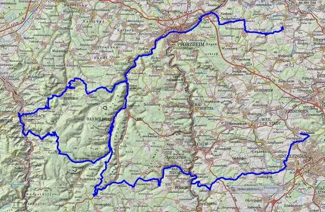
Musste die Tour leider in Sprollenhaus abbrechen, da ich Nachmittags zum Kaffeetrinken zuhause sein wollte....
Tour gallery
Tour map and elevation profile
Minimum height 153 m
Maximum height 934 m
Comments
GPS tracks
Trackpoints-
GPX / Garmin Map Source (gpx) download
-
TCX / Garmin Training Center® (tcx) download
-
CRS / Garmin Training Center® (crs) download
-
Google Earth (kml) download
-
G7ToWin (g7t) download
-
TTQV (trk) download
-
Overlay (ovl) download
-
Fugawi (txt) download
-
Kompass (DAV) Track (tk) download
-
Track data sheet (pdf) download
-
Original file of the author (gpx) download
Add to my favorites
Remove from my favorites
Edit tags
Open track
My score
Rate


Radmarathon, der nur zum Teil wahr ist
ich denke, Du solltest den Tittel Deiner Tour ändern. Warum ? Einfach, wenn Du in Sprollenhaus aus dem Marathon aussteigen mußtest, kannst Du nicht nach ca. 50% der Strecke vom Magstädter Nordschwarzwald Marathon reden.
Solltest Du die GPS-Daten der 240 km brauchen, melde Dich.
Grüße
Andreas E aus D