Login

Forgotten password?

Cookies have to be accepted!
Your browser's cookie functionality is disabled. Please enable this functionality.

Not a member yet?

Register now
Login

Available for registred users only

Log in to use this feature.

Forgotten password?

Cookies have to be accepted!
Your browser's cookie functionality is disabled. Please enable this functionality.

Not a member yet?

Register now
Filter
Categories
Advanced filters
  • Distance (km)
  • Height
Save filters Reset filter

TrackRank

QRCode

Technical data

Distance17,9 km Height795 m Way down794 m Duration05:00 h:m Date09.02.2010
Scores Author Landscape Fun factor Fitness Technique

Statistics

1011 Views Scores 347 Downloads Average
Rate
  • Track data sheet
  • Directions
  • Downloads

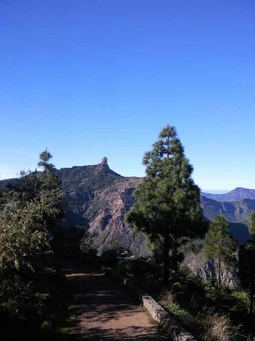
Folgt noch. Ist aus einem bekannten Wanderführer und kombiniert mit einem Abstecher zum Roque Nublo dann über La Culata

Tour gallery

Tour map and elevation profile

  • Open Street Map
  • Google
Minimum height 1223 m Maximum height 1700 m Detailed view

More about the tour author

Joachimr
Member since 2009

Send private message

Comments

Cruz de Tejeda Parkplatz, dann an der Bar / Restaurant xxxx vorbei

GPS tracks

Trackpoints
  • GPX / Garmin Map Source (gpx) download
  • TCX / Garmin Training Center® (tcx) download
  • CRS / Garmin Training Center® (crs) download
  • Google Earth (kml) download
  • G7ToWin (g7t) download
  • TTQV (trk) download
  • Overlay (ovl) download
  • Fugawi (txt) download
  • Kompass (DAV) Track (tk) download
  • Track data sheet (pdf) download
  • Original file of the author (gpx) download

More about the tour author

Joachimr
Member since 2009

Send private message
Share track
Add to my favorites
Remove from my favorites
Edit tags
My score
Rate
Track: Tejeda Rundwanderung
Type: Hiking
Distance: 17,9 km
Evaluated on:
Duration:
Day(s)
Hour(s)
Minute(s)
Score: Landscape Fun factor Fitness Technique