Login

Forgotten password?

Cookies have to be accepted!
Your browser's cookie functionality is disabled. Please enable this functionality.

Not a member yet?

Register now
Login

Available for registred users only

Log in to use this feature.

Forgotten password?

Cookies have to be accepted!
Your browser's cookie functionality is disabled. Please enable this functionality.

Not a member yet?

Register now
Filter
Categories
Advanced filters
  • Distance (km)
  • Height
Save filters Reset filter

TrackRank

QRCode

Technical data

Distance7,1 km Height876 m Way down878 m Duration01:50 h:m Date28.02.2010
Scores Author Landscape Fun factor Fitness Technique

Statistics

1108 Views Scores 61 Downloads Average
Rate
  • Track data sheet
  • Directions
  • Downloads

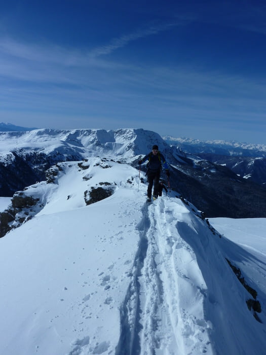
Schöne, sichere Tour mit super Ausblick auf die Dolomiten.

Los gehts am Liftparkplatz und dann rechts neben der Piste am Skitourenweg aufwärts.

Abfahrt größtenteils auf der Piste und Funpark.

Tour gallery

Tour map and elevation profile

  • Open Street Map
  • Google
Minimum height 1573 m Maximum height 2464 m Detailed view

More about the tour author

Blatterter
Member since 2009

Send private message

Comments

 Von Bozen aus ins Sarntal nach Reinswald. Start am Lift

GPS tracks

Trackpoints
  • GPX / Garmin Map Source (gpx) download
  • TCX / Garmin Training Center® (tcx) download
  • CRS / Garmin Training Center® (crs) download
  • Google Earth (kml) download
  • G7ToWin (g7t) download
  • TTQV (trk) download
  • Overlay (ovl) download
  • Fugawi (txt) download
  • Kompass (DAV) Track (tk) download
  • Track data sheet (pdf) download
  • Original file of the author (gpx) download

More about the tour author

Blatterter
Member since 2009

Send private message
Share track
Add to my favorites
Remove from my favorites
Edit tags
My score
Rate
Track: Skitour aufs Sattele - Sarntal - Reinswald
Type: Ski touring
Distance: 7,1 km
Evaluated on:
Duration:
Day(s)
Hour(s)
Minute(s)
Score: Landscape Fun factor Fitness Technique