
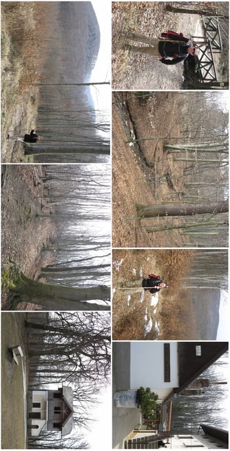

Beim Parkplatz am Ende der Schwarzenbergallee beginnt unsere Wanderung. Vom Parkplatz über den Kinderspielplatz und die kleine Brücke Richtung Wiese. Im Wald am Eckbach (links) entlang Richtung Exelberg. Weiter gehts Richtung Rosskopfwiese (Trappelweg rechts auf den Berg rauf) und dort über einen alten Pfad durch den Wald runter zur Mountainbike-Strecke.
Unmittelbar nach dem Abstieg gehts auch schon wieder auf den Berg rauf (links). Auf einem alten aber gut sichtbaren Forstweg über entwurzelte Bäume hinweg ca. 280 m zur Toiflhütte.
Von dort den gut beschilderten Wanderweg (rechts) zum Fuße des Hameau und den sehr steilen Anstieg rauf auf das Hameau Plateau.
Von dort den breiten Wanderweg hinunter zur Wiese und Parkplatz.
Tour map and elevation profile
Minimum height 280 m
Maximum height 466 m
More about the tour author
|
|
huberj59 |
Comments

Höhenstraße bzw. Neuwaldegg bis zur Exelbergstraße und Parkplatz.
GPS tracks
Trackpoints-
GPX / Garmin Map Source (gpx) download
-
TCX / Garmin Training Center® (tcx) download
-
CRS / Garmin Training Center® (crs) download
-
Google Earth (kml) download
-
G7ToWin (g7t) download
-
TTQV (trk) download
-
Overlay (ovl) download
-
Fugawi (txt) download
-
Kompass (DAV) Track (tk) download
-
Track data sheet (pdf) download
-
Original file of the author (gpx) download
More about the tour author
|
|
huberj59 |
Add to my favorites
Remove from my favorites
Edit tags
Open track
My score
Rate