


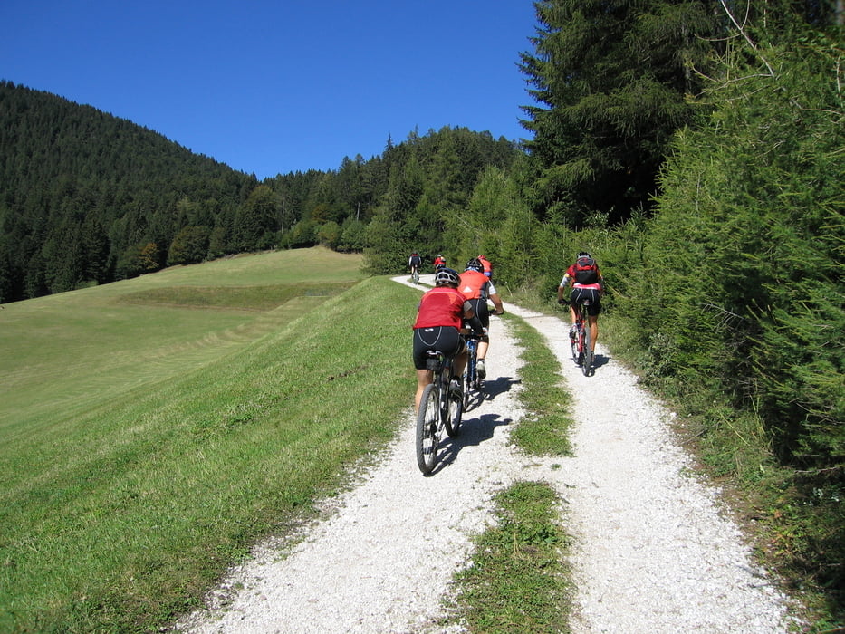
Von Tramin aus durch die Obst- und Weinberge bis nach Salurn. Hier befindet sich die Sprachgrenze, das Ende des deutschen Kulturraumes. Die Haderburg an den Kalksteinfelsen geklebt zeugt von einer ereignissreichen Geschichte. Wir fahren aber weiter nicht zu steil bergauf auf den Geierberg. Von hier gehts durch Laubwälder hinüber bis zum Passo Sauch und weiter zum Lago Santo auf 1200 m über Meer. Nachdem wir uns am See ein wenig vom Anstieg erholt haben, gehts über den Europäischen Fernwanderweg E5 weiter nach Gfrill. Von hier aus haben wir mehrere Möglichkeiten ins Tal abzufahren. Schwierige Singletrails oder breite Forstwege, für jeden ist etwas dabei.
Further information at
http://www.traminerhof.it/deutsch/mountainbike/touren/mountainbike-touren/lago-santo-heiliger-see.htmlTour gallery
Tour map and elevation profile
Minimum height 151 m
Maximum height 1205 m
More about the tour author
|
|
Armin Pomella |
Comments

Über die Brennerautobahn bis zur Ausfahrt Neumarkt/Auer/Tramin.
Von dort weiter 4 km bis Tramin. Parken beim Bikehotel Traminer Hof.
GPS tracks
Trackpoints-
GPX / Garmin Map Source (gpx) download
-
TCX / Garmin Training Center® (tcx) download
-
CRS / Garmin Training Center® (crs) download
-
Google Earth (kml) download
-
G7ToWin (g7t) download
-
TTQV (trk) download
-
Overlay (ovl) download
-
Fugawi (txt) download
-
Kompass (DAV) Track (tk) download
-
Track data sheet (pdf) download
-
Original file of the author (gpx) download
More about the tour author
|
|
Armin Pomella |
Add to my favorites
Remove from my favorites
Edit tags
Open track
My score
Rate