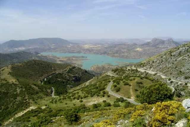
Im Juni 2005 habe ich eine Radwanderung durch den äußersten Süden Andalusiens unternommen. Hier gibt es ein paar schöne Gebirge, wie die Sierra de Ubrique und die Sierra de Grazalema, die zum Rad- und Fußwandern einladen. Einen schönen Ausblick bietet die CA 531 von Grazalema nach Zahara de la Sierra, die über den Puerto de las Palomas führt.
Zudem machte ich zwei kleine Abstecher nach Gibraltar und nach Marokko. (Marokko ist nicht mit auf dem Track.)
Mehr steht auf meiner Web-Seite. (s.u.)
Zudem machte ich zwei kleine Abstecher nach Gibraltar und nach Marokko. (Marokko ist nicht mit auf dem Track.)
Mehr steht auf meiner Web-Seite. (s.u.)
Further information at
http://www.radwahn.deTour gallery
Tour map and elevation profile
Minimum height -9 m
Maximum height 1190 m
Comments

Der Campingplatz Torre de la Peña liegt etwa 7 km nord-westlich von Tarifa an der N340. Hier konnte ich während der Tour mein Auto lassen. Zum Übernachten hatte ich einen erstklassigen Stellplatz ganz oben unter Bäumen mit Blick auf Afrika. Das Camping-Personal war sehr freundlich.
GPS tracks
Trackpoints-
GPX / Garmin Map Source (gpx) download
-
TCX / Garmin Training Center® (tcx) download
-
CRS / Garmin Training Center® (crs) download
-
Google Earth (kml) download
-
G7ToWin (g7t) download
-
TTQV (trk) download
-
Overlay (ovl) download
-
Fugawi (txt) download
-
Kompass (DAV) Track (tk) download
-
Track data sheet (pdf) download
-
Original file of the author (gpx) download
Add to my favorites
Remove from my favorites
Edit tags
Open track
My score
Rate


