


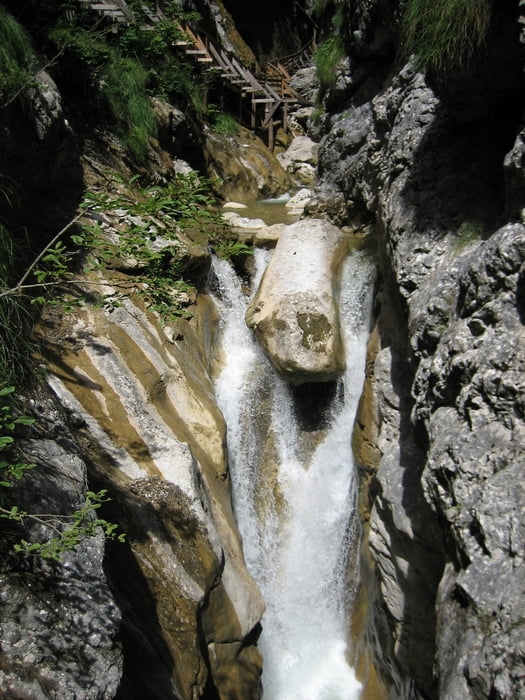
Die wildromantische Wörschachklamm wurde bis 1896 von Fuhrleuten als Transportweg für Holz und Holzkohle verwendet. Da aber das Befahren der Holzbrücken in der steilen Schlucht mit Pferdefuhrwerken sehr gefährlich war, gab man den Transportweg auf. Heute führt ein gut gesicherter Steig mit vielen Holzstiegen und Brücken durch die Wörschachklamm. Mit seinen vielen kleinen Wasserfällen ist die Wörschachklamm ein sehr leicht zu erreichendes und sehenswertes Ausflugsziel in der Obersteiermark.
Weitere Infos und Fotos findest du auf - biketours4you.at
Tour gallery
Tour map and elevation profile
Minimum height 647 m
Maximum height 1116 m
More about the tour author
|
|
Trek1400d |
Comments

GPS tracks
Trackpoints-
GPX / Garmin Map Source (gpx) download
-
TCX / Garmin Training Center® (tcx) download
-
CRS / Garmin Training Center® (crs) download
-
Google Earth (kml) download
-
G7ToWin (g7t) download
-
TTQV (trk) download
-
Overlay (ovl) download
-
Fugawi (txt) download
-
Kompass (DAV) Track (tk) download
-
Track data sheet (pdf) download
-
Original file of the author (gpx) download
More about the tour author
|
|
Trek1400d |
Add to my favorites
Remove from my favorites
Edit tags
Open track
My score
Rate