Login

Forgotten password?

Cookies have to be accepted!
Your browser's cookie functionality is disabled. Please enable this functionality.

Not a member yet?

Register now
Login

Available for registred users only

Log in to use this feature.

Forgotten password?

Cookies have to be accepted!
Your browser's cookie functionality is disabled. Please enable this functionality.

Not a member yet?

Register now
Filter
Categories
Advanced filters
  • Distance (km)
  • Height
Save filters Reset filter

TrackRank

QRCode

Technical data

Distance44,0 km Height603 m Way down613 m Duration04:00 h:m Date02.10.2010
Scores Author Landscape Fun factor Fitness Technique

Statistics

661 Views Scores 111 Downloads Average
Rate
  • Track data sheet
  • Directions
  • Downloads

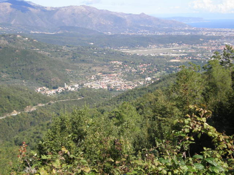
 Zunächst 10km stetig bergauf bis Testico (406m). Für geübte Alpenisten kein Problem, für mich als "Flachländer" aber ganz schön anstrengend. Dann aber tolles Panorama mit Blick aufs Meer und Flughafen Garlenda und super Fahrt bis Alassio. Nach Laguiglia kurze Steigung, dann runter nach Andora und zurück nach Bossaneto.

Dieci cilometri solo da su, per me molto stressante, ma poi grande vista sul aeroporto Garlende e sul mare.


Tour gallery

Tour map and elevation profile

  • Open Street Map
  • Google
Minimum height 8 m Maximum height 478 m Detailed view

More about the tour author

GuenterM
Member since 2010

Send private message

Comments

GPS tracks

Trackpoints
  • GPX / Garmin Map Source (gpx) download
  • TCX / Garmin Training Center® (tcx) download
  • CRS / Garmin Training Center® (crs) download
  • Google Earth (kml) download
  • G7ToWin (g7t) download
  • TTQV (trk) download
  • Overlay (ovl) download
  • Fugawi (txt) download
  • Kompass (DAV) Track (tk) download
  • Track data sheet (pdf) download
  • Original file of the author (gpx) download

More about the tour author

GuenterM
Member since 2010

Send private message
Share track
Add to my favorites
Remove from my favorites
Edit tags
My score
Rate
Track: Vor dem Erfolg haben die Götter den Schweiß gesetzt!
Type: Mountain bike
Distance: 44,0 km
Evaluated on:
Duration:
Day(s)
Hour(s)
Minute(s)
Score: Landscape Fun factor Fitness Technique