


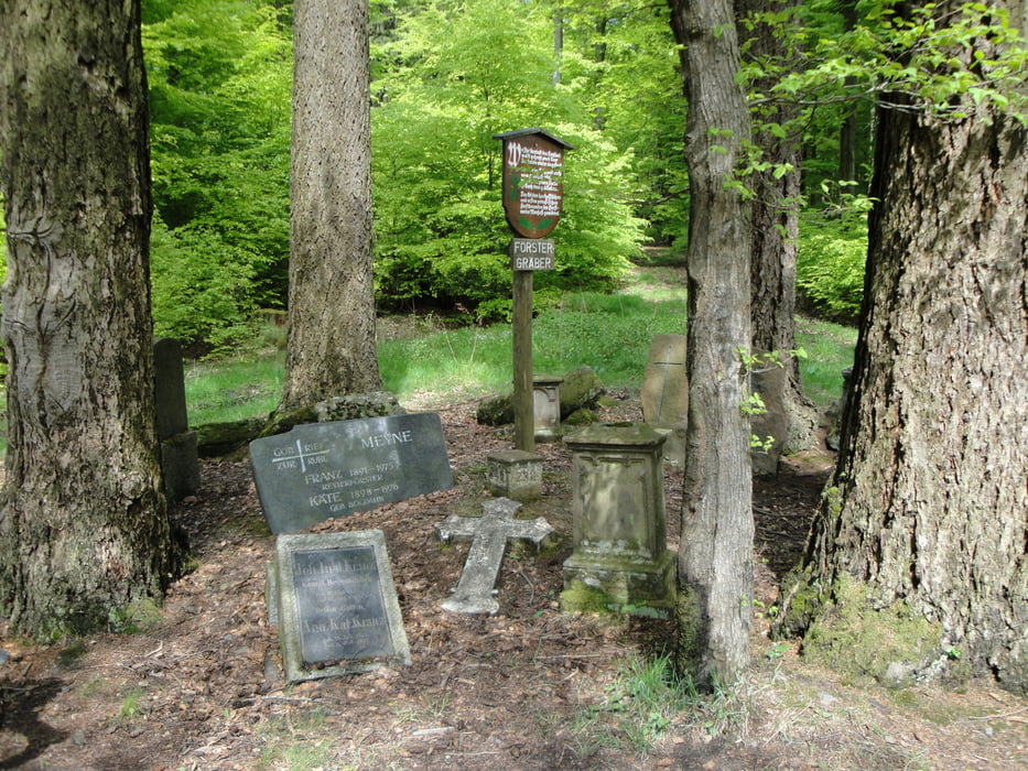
Von Bad Soden Salmünster Ahl zum Jägerheiligen ( Berg 1 Schönbornkopf 428m) nach Alsberg am Golfpaltz vorbei ( Berg 2 Schnepfenkopf 490m) zu den Förstergräbern.
Um den Dischenstein ( Berg 3 Dischenstein 470m) herum nach Seidenroth.
Auf dem Denullweg wieder zum Jägerheilge den Canyon runter (Trailstück ca 1,5km) um den Rauhen Berg (Berg 4 Rauher Berg) herum wieder nach Ahl.
Trailstück bei Nässe noch nicht gefahren!
Further information at
http://www.badsoden-salmuenster.de/Tour gallery
Tour map and elevation profile
Minimum height 153 m
Maximum height 488 m
More about the tour author
|
|
Peter-Hans |
Comments

BAB 66 Ausfahrt BAd Soden Salmünster
Parken Kinzigtalstausee, Bikeschmiede Ahl
GPS tracks
Trackpoints-
GPX / Garmin Map Source (gpx) download
-
TCX / Garmin Training Center® (tcx) download
-
CRS / Garmin Training Center® (crs) download
-
Google Earth (kml) download
-
G7ToWin (g7t) download
-
TTQV (trk) download
-
Overlay (ovl) download
-
Fugawi (txt) download
-
Kompass (DAV) Track (tk) download
-
Track data sheet (pdf) download
-
Original file of the author (gpx) download
More about the tour author
|
|
Peter-Hans |
Add to my favorites
Remove from my favorites
Edit tags
Open track
My score
Rate